Gauging Floridan Aquifer Groundwater, New Source For Titusville, Florida
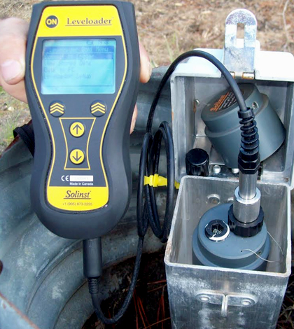
A field technician downloads water level and conductivity data to a Solinst Leveloader, recently replaced by the Levelogger App Interface and the Solinst DataGrabber. (Credit: Richard Crum / City of Titusville, Florida)
A few years ago, the City of Titusville, Florida, embarked on a new project to add another source of drinking water for its residents. This effort centered on the creation of the Area IV wellfield, set up to pump groundwater from the Floridan aquifer to supplement amounts taken from the Surficial Aquifer.
The new wellfield area is located in northwest Brevard County, and required a lot of prep work and public-private cooperation to get built. This included the construction of a 12-mile pipeline from the wellfield to the Mourning Dove water treatment facility.
Much of the support for constructing the Area IV wellfield came from the fact that its addition to the city’s water system wouldn’t affect operations at the water treatment plant or require further updates to the city’s water supply pipeline.
Nowadays, with water drawn from the Floridan aquifer mixed directly with other groundwaters at the treatment facility, residents of the city have noticed no differences in taste or quality. The addition of the new waters has been fairly seamless.
In addition to that mixing, there are other actions that wellfield managers take to ensure that the quality of the water coming out stays consistent. They track the levels of the aquifer to monitor its supply, in addition to its conductivity levels.
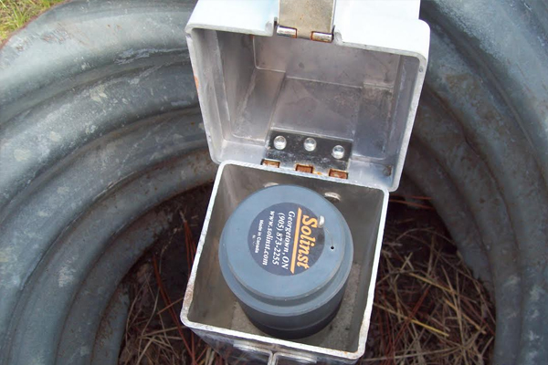
Groundwater well at the Area IV wellfield. (Credit: Richard Crum / City of Titusville, Florida)
“If the groundwater levels increase or the salinity increases, it may show problems in the amount being pumped, plus exceed what we are allowed,” said Richard Crum, chief maintenance mechanic with the City of Titusville’s Water Production unit. Taking these measures also satisfies the terms of a consumptive water use permit.
Water level is tracked using Solinst Leveloggers. To also keep tabs on conductivity, Crum and others depend on a Solinst LTC Levelogger Junior Water Level & Conductivity Logger. He notes that a two-man crew typically goes out to retrieve the sensor data, which are later stored in a database for review.
“We are required to produce our findings twice a year to the local water authority (St. Johns River Water Management District),” said Crum.
So far, the data collected have indicated that withdraws from the aquifer are well within limits. And the quality of the water has held steady.
“Everything is working as predicted, and we don’t like surprises!” said Crum.
Top image: A field technician downloads water level and conductivity data to a Solinst Leveloader, recently replaced by the Levelogger App Interface and the Solinst DataGrabber. (Credit: Richard Crum / City of Titusville, Florida)


0 comments