Mapping service works to sort forests from plantations in troublesome satellite data
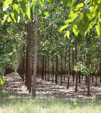
This acacia timber plantation in Colombia may be defined as a forest by satellite data. (Credit: Rhett A. Butler)
Current aerial monitoring technology can’t necessarily detect the removal of forest to create plantations, according to a recent article in South Australia’s The Star Online. That means countries can paint a rosier picture of the environmental health of their forests than the reality.
Although monitoring forests by plane is efficient and allows monitoring even of remote and difficult terrain, it can’t necessarily distinguish between primary and secondary forests, or even between forests and plantations, essentially labeling them all as tree cover.
Global Forest Watch, the World Resources Institute’s forest cover mapping service, has dealt with this very problem: is it a forest or a plantation? The organization is having experts look at satellite images to see what cues they can find that distinguish forests from plantations, such as the presence of characteristic road networks. Global Forest Watch has also recently given its users the ability to define, to some extent, what qualifies as a forest in their eyes and to filter images through those parameters.
Other monitoring difficulties include accounting for new forest growth and defining what percentage of canopy cover qualifies as a forest, as the percentage varies from country to country.
Top image: This acacia timber plantation in Colombia may be defined as a forest by satellite data. (Credit: Rhett A. Butler)


0 comments