
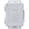
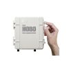
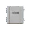
HOBO Temperature Smart Sensor
The Onset Temperature Smart Sensor provides < ± 0.2° C total accuracy (< ±0.36° F) and resolution of < ± 0.03° C (< ±0.054° F) over the range of 0° to 50° C (32° to 122° F).
Features
- Measurement range of -40° to 100°C (-40° to 212°F)
- Stainless steel sensor tip
- Sensor and cable rated for immersion in water or soil up to 50°C for up to 1 year
- Expedited repair and warranty service
- Lifetime technical support
- More
Overview
The Onet 12-bit Temperature Smart Sensor provides < ± 0.2° C total accuracy (< ±0.36° F) and resolution of < ± 0.03° C (< ±0.054° F) over the range of 0° to 50° C (32° to 122° F). The full measurement range is -40° to 100° C (-40° to 212° F). A selectable measurement-averaging feature further improves accuracy. Available in cable lengths of 2m, 6m and 17m.
|
Measurement Range |
-40° to 100°C (-40° to 212°F) – sensor tip |
| Accuracy | < ±0.2°C from 0° to 50°C (< ±0.36°F from 32° to 122°F)* |
| Resolution | <0.03°C from 0° to 50°C (<0.054°F from 32° to 122°F) |
| Drift | <0.1°C (0.18°F) per year** |
| Response Time (to 90% of change) | <2 minutes typical in 2 m/sec (4.5 mph) moving air flow <1 minute typical in stirred water bath |
| Environmental Operating Ranges | Smart sensor adapter: -40° to 75°C (-40°F to 167°F); weatherproof, IP67 Stainless-steel sensor tip and cable jacket: Waterproof over the range of -40° to 50°C (-40°F to 122°F) for 1 year; operation up to 100°C (212°F) in air |
| Housings | Stainless steel waterproof sensor tip; weatherproof polyamide housing for smart sensor adapter |
| Dimensions | Temperature probe: 5.0 x 26 mm (0.2 x 1.0 inches) |
| Weight | 2 meter: 0.09 g (3.3 oz) 6 meter: 0.14 g (5.2 oz) 17 meter: 0.30 g (11.2 oz) |
| Bits per Sample | 12 |
| Number of Data Channels*** | 1 |
| Measurement Averaging Option | Yes |
| Cable Lengths Available | 2 m (6.6 ft) S-TMB-M002 6 m (19.7 ft) S-TMB-M006 17 m (55.8 ft) S-TMB-M017 |
| Length of Smart Sensor Network Cable | 0.5 m (1.6 ft) for all models |
*Radiation Shield strongly recommended for use in sunlight (listed in Accessories tab)
**The drift specification of <0.1°C (0.18°F) per year may be exceeded when using the probe continuously in water >50°C (122°F).
***A single HOBO station can accommodate 15 data channels and up to 100 m (328 ft) of smart sensor cable (the digital communications portion of the sensor cables).
Select Options


In The News

From Paddles to Phytoplankton: Studying Vermont’s Wildest Lakes
For six months of the year, Rachel Cray, a third-year PhD student at the Vermont Limnology Laboratory at the University of Vermont, lives between a microscope and her laptop, running data. For the other six months, she is hiking and canoeing four of Vermont’s lakes, collecting bi-weekly water samples. Cray studies algal phenology across four lakes in Vermont, US, that have low anthropogenic stress—or in other words, are very remote. Funded by the National Science Foundation Career Award to Dr. Mindy Morales, the lakes Cray researches part of the Vermont Sentinel Lakes Program, which studies 13 lakes in the area and, in turn, feeds into the Regional Monitoring Network, which operates in the Northeast and Midwest US.
Read More
Reimagining Water Filtration: How Monitoring and Science Enhance FloWater Filtration Systems
Over 50% of Americans think their tap water is unsafe , according to the Environmental Working Group (EWG). Other recent surveys have found that number to be as high as 70% of persons surveyed. Whether due to increased public awareness of water quality issues or confusion about how municipal water sources are regulated, there is a clear distrust of tap water in the United States. According to industry expert Rich Razgaitis, CEO and co-founder of the water purification company FloWater, this issue creates a damaging cycle. Razgaitis explained that the health and environmental problems associated with contaminated water aren’t the only issues. As people become increasingly aware that some tap water is unsafe, they resort to bottled water.
Read More
Monitoring New Hampshire’s Aquatic Ecosystems: Continuous Data Collection in the Lamprey River Watershed
New Hampshire’s aquatic ecosystems provide a range of ecosystem services to the state and region. Resources and services like clean water, carbon storage, climate regulation, nutrient regulation, and opportunities for recreation all depend on New Hampshire’s aquatic ecosystems remaining healthy. Jody Potter, an analytical instrumentation scientist at the University of New Hampshire (UNH), is studying these aquatic ecosystems in hopes of developing an improved understanding of ecosystem services and their interactions with climate change, climate variability, and land use changes. [caption id="attachment_39799" align="alignnone" width="940"] Aquatic sensors in the Merrimack River in Bedford, NH, with I-293 in the background.
Read More