30 Minutes to Act: University City’s Award-Winning Flash Flood Prediction System
Flooding is already the deadliest severe weather hazard in Missouri, and under high-emissions scenarios, the central US is predicted to emerge as a flash flooding hotspot.
University City, a suburb of St Louis, Missouri, is “violently” and “frequently” flooded by the River Des Peres, as Eric Karch–a civil engineer and one of University City’s Stormwater Commissioners–explains.
The River Des Peres is Missouri’s most flash flood-prone stream, with a complex and deeply urban history. At the beginning of the 20th century, a 4-mile portion of the 18-mile river was buried to hide the sight and smell from visitors to the 1904 World Fair. Decades later, to combat flooding, much of the remaining length was channelized.
More recently, interest is focused on flood mitigation and more natural restoration, and in 2019, the University City Stormwater Commission was mayorally appointed.
Comprising seven volunteer commissioners–including Karch–the Commission makes recommendations to government officials for positive, corrective actions “that will reduce people’s risk of flooding and stormwater related issues.”
In 2008 and 2022, a Springer Nature article reports that University City experienced “massive flooding.” During this event, “Hundreds of homes were inundated in basements and on the first floor […]. In 2022, some residents even woke up in their beds with water on their backs and had to swim out in the pre-dawn darkness,” Karch recalls.
These events catalyzed the installation of enhanced instrumentation on the River Des Peres, with the twofold aims of providing a historical record of rainfall and river water level, as well as to act as a flood warning system.
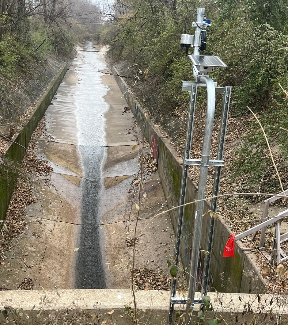
Adjustments being made to one of the systems, which sits at a tunnel mouth. (Credit: Eric Karch)
Monitoring the River Des Peres
Flash flooding happens rapidly–generally within six hours–of the causal event, but the response time on the River Des Peres can be as little as 1 hour.
Partially because of their rapid onset, data at a fine spatial and temporal resolution is needed to predict these events–a far cry from the “broad brush, state and federal level [flood] warnings” that existed before University City’s system was installed.
Karch reflects that installing this monitoring system was a long time in the works and represented a “big win.”
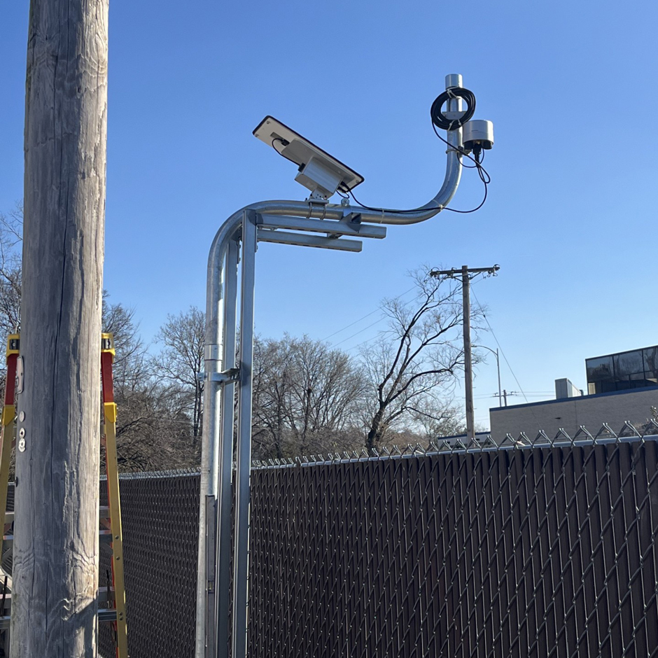
Three rain gauges were installed in 2021, strategically located to the west of town, where rainfall typically comes from. Two Geolux LX-80 Non-Contact Level Sensors were added in 2025, alongside a NexSens X-series data logger.
Equipment was chosen carefully, considering budget, maintenance rigor, reliability, and transmission of real-time data–“To be able to have a unit that communicates with a cell signal and updates continuously is a benefit,” Karch notes.
Additionally, HOBO MX20L Water Level Loggers have also been deployed, though these require manual data download every three months.
The Commission has also added a camera system. Live pictures from two locations along the river enable the team to remotely ground truth sensor data using graduated stage gauges installed on the river wall.
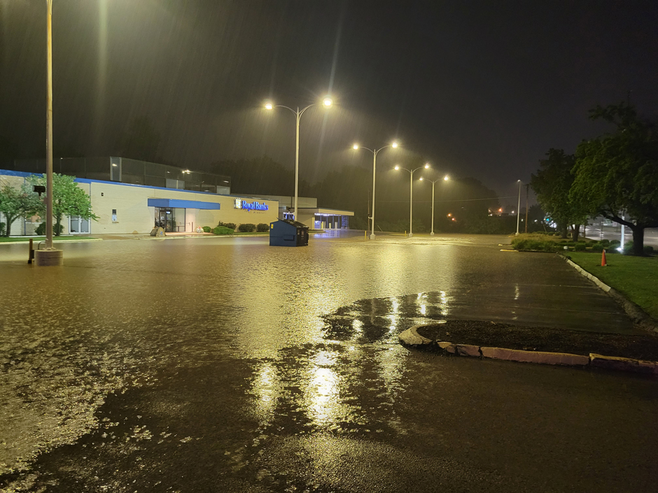
Flooding in July 2022. The water level in the River Des Peres rose approximately 18 feet and caused in excess of $30 million of damage. (Credit: Eric Karch)
Predicting Flash Flooding
Initial calibration of the rainfall-response behavior of the upper River des Peres was made by taking nearly 3 million historic data points from the United States Geological Survey (USGS) pressure transducer water level gauge on the River Des Peres, and utilizing historic data from six rain gauges managed by the Metropolitan St. Louis Sewer District in or near the watershed. The Stormwater Commission now makes real-time predictions of future flood events using the up-to-date data from their own online rain gauge network, the University City Flood Warning System.
One of Karch’s fellow commissioners, Dr. Robert Criss, is a Professor Emeritus at Washington University. Together with the late commissioner Eric Stein, Dr. Criss developed an algorithm to calculate the relationship between rainfall rate and river rise.
“It’s a complicated relationship, but it can be boiled down to the fact that if we receive 1.5 inches of rain per hour, we’re going to have serious flooding,” Karch states.
Live data sent from the X-Series data logger is fed into the Stormwater Commission’s database and run through the algorithm.
If the system records 1.5 inches of rain in an hour, an alarm is issued to the fire chief. This initiates a cascade, whereby emergency medical services are mobilized, police start blocking roads, and ambulances are put on standby.
The system can provide about 30 minutes of warning before a flood. Although not much, “the water level on the river can rise 12 feet in 60 minutes,” Karch explains–so every minute matters.
Flood events since the installation of the system have demonstrated its effectiveness in providing half an hour’s warning. While improvements can be made, Dr. Criss has educated the Commission on the trade-off between earlier warning and false alarms.
Channelization and straightening, alongside the use of impervious materials, are just some of the human factors contributing to the River Des Peres’ susceptibility to flooding. (Credit: Eric Karch)
The Future of Flood Prediction
In 2022, the Stormwater Commission won the Association of State Floodplain Managers’ James Lee Witt Local Award for Excellence in Floodplain Management, recognizing the development and deployment of this system and ongoing efforts to safeguard the community.
Despite the transformational nature of the system, the Commission is not resting on its laurels, and has provided a list of flood mitigation recommendations to City officials and continues to advocate that the City implement them.
Karch’s fellow commissioner, Dr. Criss, continues to investigate related topics such as the rate at which the flood wave moves relative to the stream velocity. “Spatial data provided by the river instrumentation can help confirm or disprove those theories,” Karch highlights.
“Ultimately, what we would like to do is improve this system to where it can alert people directly,” he adds.
The flood monitoring and prediction system developed by the University City Stormwater Commission is a powerful example of how technology and data can support communities facing challenges of extreme weather.
With urban flash flooding anticipated to become more extreme in an era of anthropogenic climate change, systems like this will be increasingly important–not just as warning mechanisms, but as tools for resilience, planning, and public safety.
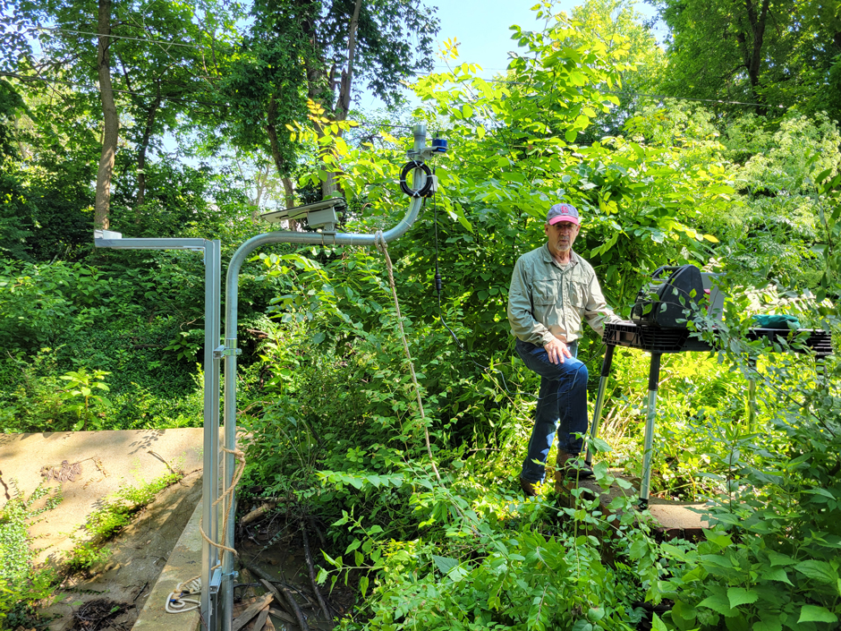
Installation underway of the sensor systems. These provide live data to provide predictions of local flash flooding. (Credit: Eric Karch)


0 comments