Green Water in Green Bay: Using Data Buoys to Monitor the Southern Bay
While the bay of Green Bay has been referred to as the largest freshwater “estuary” in the world, the watershed hosts intensive agriculture and contributes one-third of Lake Michigan’s total phosphorus load.
The Fox River flows into the bay, carrying excess nutrients largely the result of non-point source runoff from the watershed. With a history of deterioration extending well into the last century, the bay ecosystem suffered significant declines in water quality.
This, in turn, stimulated major clean-up and ongoing restoration efforts to improve water quality. Tracking these changes is an important aspect of ecosystem management.
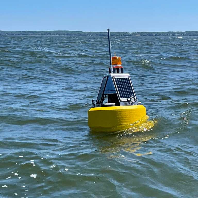
Gleaming and new, the first LoRa buoy is deployed in lower Green Bay, ready to collect valuable, real-time surface algal pigment, temperature profile, and dissolved oxygen data for its first season. (Credit: Jessie Grow / UW-Milwaukee)
Researchers at the University of Wisconsin (UW) have been studying the bay for decades, and actively monitoring remotely since 2012. More recently, Jessie Grow (UW-Milwaukee), Michael Zorn (UW-Green Bay), and J. Val Klump (UW-Milwaukee) have deployed NexSens data buoys in the bay to monitor water quality.
Two integrated and related efforts are being pursued:
- Monitoring hypoxic dead zones in the bottom waters of southern Green Bay
- Providing real-time data on harmful algal blooms
Water Quality Issues Impacting the Bay
Due to the bay’s consistent exposure to environmental stressors, Green Bay represents a model mesocosm of nearly all of the stressors that have disrupted the Great Lakes for more than a century. For example, the bay has suffered from excessive algal growth, harmful algal blooms (HABs), decreased water clarity, decreased submerged aquatic vegetation, and hypoxia.
In addition, as industrialization grew in the 1900s, primarily in the form of paper mills, the bay’s sediments became polluted with organic contaminants (like PCBs).
The health of the system has been highlighted by the International Joint Commission, which designated the lower bay as an Area Of Concern (AOC), with 13 of a possible 14 Beneficial Use Impairments (BUIs) present in the late 1980s. While there has been progress on mitigating these BUIs, 10 still remain.
“While a lot of that has now been cleaned up, it was at the cost of $1.3 billion. Now, non point source pollution–which we knew then had major impacts on our quality in the bay–has remained largely an unsolved problem,” recalls Klump.
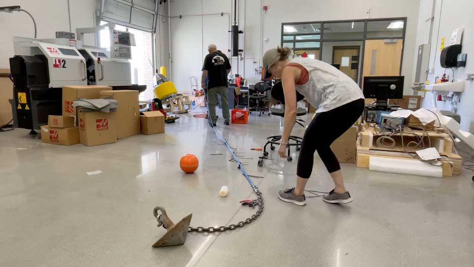
Cable-ties fly as Dr. Val Klump (left) and Jessie Grow (right) put the finishing touches on the mooring line and dissolved oxygen cable for one of the NexSens CB-150 systems prior to deployment. (Credit: Jessie Grow / UW-Milwaukee)
Like other water bodies, Green Bay has been impacted by climate change. Predictions for the future of the region under climate models show warmer winters, increased precipitation, warmer and more prolonged summers, and a higher frequency of extreme events.
“These changes have the potential to exacerbate an already degraded system, with the potential for ‘dead zones’ and adverse impacts on the biota becoming both more frequent and extensive,” cautions Klump.
He adds, “Fish kills from hypoxia, while rare, augur to be an increasing concern, particularly for commercial fishing operators.”
Additionally, the bay has seen an increase in the intensity and frequency of harmful algal blooms in recent years, occurring as far north as off Sturgeon Bay and as late in the season as October.
Monitoring Water Quality in Green Bay
Piloted for the first time in 2022, two NexSens buoys (a CB-50 and a CB-150) configured with LoRaWAN technology were deployed in the bay. The following season, in 2023, the systems were refined, and three additional CB-150 buoys were added.
The project continues in 2024, with a focus on designing a smaller, lower-cost LoRaWAN buoy that will ultimately allow for more sensors to be deployed and improve the team’s overall understanding of hypoxia and algal bloom dynamics.
Buoy size, customizable mooring, sensor compatibility, power efficiency, and future-proof capabilities were at the forefront of considerations for the platforms.
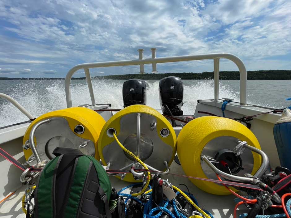
With prototyping and testing complete, 3 finished systems are loaded up and battened down for a quick boat ride to their respective deployment sites in lower Green Bay. (Credit: Jessie Grow / UW-Milwaukee)
“We wanted smaller platforms that 1-3 people could easily deploy, service, and recover from a smaller watercraft,” states Grow.
Due to limited access to winches on vessels, mooring/anchor systems needed to be relatively simple to maneuver by hand. Additionally, since deployment site depths ranged from 5-15 meters, custom mooring lines with enough slack to account for wave action were created for each site.
The team worked with the Wisconsin Department of Natural Resources to ensure systems were properly lighted with solar beacons and added to the Notice to Mariners to avoid any collisions. Finally, the buoys were deployed in the lower bay.
Grow elaborates, “Site selection was based on historical sampling stations going back to the 1980’s where sonde profiles were taken at various points throughout the bay’s stratification period. The bay’s SE region has the most frequent occurrences of bottom-water hypoxia, wherein hypoxic ‘blobs’ can vary significantly in location, duration, and even depth.”
On the CB-50, a NexSens temperature string (4 nodes) allows the team to monitor temperature throughout the water column (0.5m, 3m, 4m, and 5m), and a bottom In-Situ RDO Blue dissolved oxygen/temperature sensor combination allows them to record stratification and any periods of hypoxia at the site.
The CB-150 is equipped with the same In-Situ dissolved oxygen bottom sensor as well as two optical Yosemitech sensors at the surface, which monitor chlorophyll-a and phycocyanin fluorescence, as well as temperature.
NexSens buoys were chosen as the platforms for both sites because the team had over ten years of experience working with these systems on other projects. For this project specifically, the customization and ease of maintenance were key considerations.
Grow explains, “We have been using NexSens buoys for over a decade, and experience tells us that they can withstand the test of time and tempest. When it comes to designing complex electrical systems that need to be able to survive the elements, confidence in the foundational platform is key, and we can rest easy knowing that the basic structure of the buoy will remain intact.”
She continues, “NexSens buoys provide an easily managed, customizable, and robust platform that is ideal for development of a sensor network that can be efficiently deployed from small watercraft, host solar power supply systems, and are readily available at a reasonable cost.”
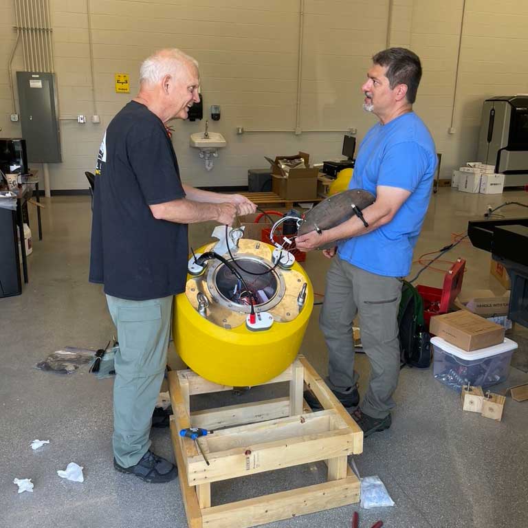
Buoy button-up is a breeze when working with long-time colleagues and friends – Dr. Val Klump (left) and Dr. Mike Zorn (right) discuss the system’s internal wiring configuration before sealing the data well with the custom-built stainless-steel lid. (Credit: Jessie Grow / UW-Milwaukee)
LoRaWAN Integrated Buoys
Cellcom, a local network services provider, installed 7 LoRaWAN gateway receivers on existing cell towers located around the lower bay of Green Bay.
Cellcom’s director of government relations and sustainability Mick O’Malley stated that, “As a local mobile wireless provider, we care about the community and the health of our local environment. Being able to use a leading technology to support critical research that can make a difference for the environment was an incredible opportunity for us. Cellcom looks forward to continuing to partner with UW Green Bay on environmental initiatives in the future.”
“The network provides wireless coverage over the water in that region, allowing the buoys to transmit data wirelessly via the network,” explains Zorn.
Each of the team’s LoRaWAN buoys are configured with Dragino LoRaWAN controllers. According to Zorn, the lack of data logging was a conscious decision.
He explains, “It allows us to build systems that are smaller, less complicated, more reliable, and less expensive. It also allows us to take advantage of LoRaWAN’s low power capabilities. The CB-50 buoy currently operates with a small internal 3.3 V battery and no solar panel.”
“These combined devices send LoRaWAN data packets out at programmed intervals to Cellcom’s mega/field gateways and then to a network server. After several additional processing steps, the data are subsequently integrated with the Great Lakes Observing System’s (GLOS) Seagull platform,” continues Zorn.
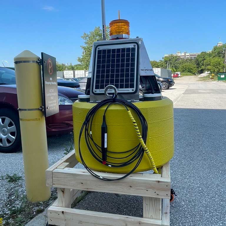
Prior to deployment, each system undergoes rigorous testing on dry land, i.e., the parking lot, to ensure all components are working properly including solar charging, water-tightness, and LoRaWAN signal strength. (Credit: Jessie Grow / UW-Milwaukee)
Future Water Quality Monitoring Efforts in Green Bay
To date, the buoys demonstrate the potential for such monitoring networks to capture the dynamics of rapidly shifting environmental conditions.
“This project will expand the pilot of such platforms and will target hypoxic dead zones in the bottom waters and HABs in surface waters as a demonstration of the potential for such arrays to capture the dynamics of rapidly shifting environmental conditions,” clarifies Zorn.
In the future, the team hopes to expand the network, adding more LoRaWAN gateways and more monitoring sites to cover the northeastern part of the bay.
For now, the data can help inform management of the bay’s fishery, a source of $260 million annually, leading to better practices, limiting losses and protecting the native species essential to the bay’s economy.
Fortunately, the team feels like interest in the bay’s health has shifted over the years.
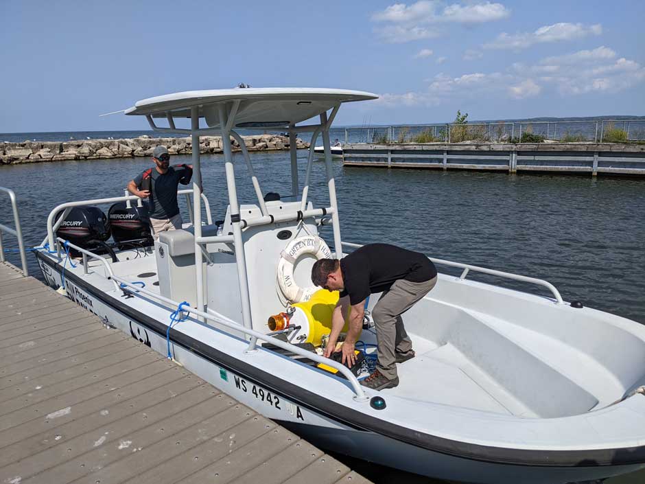
Dr. Chris Houghton (left) and Dr. Mike Zorn (right) gear up for another LoRa buoy deployment onboard UW-Green Bay’s R/V Phoenix. (Credit: Val Klump / UW-Milwaukee)
“I think that people are becoming more and more aware of the value of the bay to the quality of life in the region,” states Klump.
In late 2023, the team was made aware of a specific event wherein commercial trap nets located on Larsen’s Reef, just outside the Sturgeon Bay ship channel, were hit with hypoxic waters. This event caused the suffocation of the fish held in the trap because trap nets are normally set for 3 to 4 days.
In 2025, the team plans to test a pilot program to instrument one or more of these nets using the LoRaWAN network in areas where hypoxia has become a potential problem. Providing real-time oxygen and temperature data via the GLOS Seagull data platform could alert fishing operators to potential hypoxic waters hitting their nets, thereby allowing them to respond in a timely manner.
Conclusion
The team anticipates their findings will help make water quality data more accessible to regional shareholders in the bay and improve understanding of short-term conditions and long-term trends. Furthermore, the data can be used to build and improve existing ecosystem models.
All in all, the aim of the project is to serve the public on a direct level by providing temperature, DO, and HABs data to local boaters and anglers who rely on this real-time network to determine when and where to recreate on the bay.


Pingback: Research Brief: Influences of Lake Conditions on the Thermal Regime of the Milwaukee Estuary - Lake Scientist