How NOAA’s CURBY Aided Recovery Efforts After the 2025 DCA Plane Crash
On the evening of January 29, 2025, a military helicopter and an American Airlines flight collided midair over the Potomac River on the final approach into Ronald Reagan Washington National Airport (DCA) in Virginia, five miles from Washington, D.C.
The incident marked the first major U.S. commercial airline crash in over 15 years and resulted in the tragic loss of all passengers and crew.
In the immediate aftermath of the tragedy, emergency response agencies mobilized to search for survivors and begin recovery operations. As part of the broader interagency effort, NOAA provided environmental observing support to aid on-site teams working in challenging conditions.
Bob Heitsenrether is part of the National Oceanic and Atmospheric Administration’s (NOAA) Center for Operational Oceanographic Products and Services (CO-OPS), which is responsible for developing and maintaining US coastal ocean observing infrastructure.
Within 48 hours of the crash, the NOAA CO-OPS team had deployed a NexSens CB-950 buoy in the Potomac River. Real-time data from deployed systems helped inform dive operations and other recovery activities, contributing to the overall safety and coordination of the emergency response.

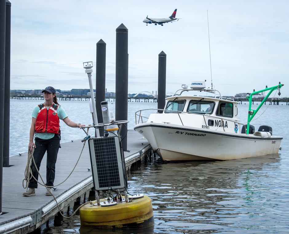
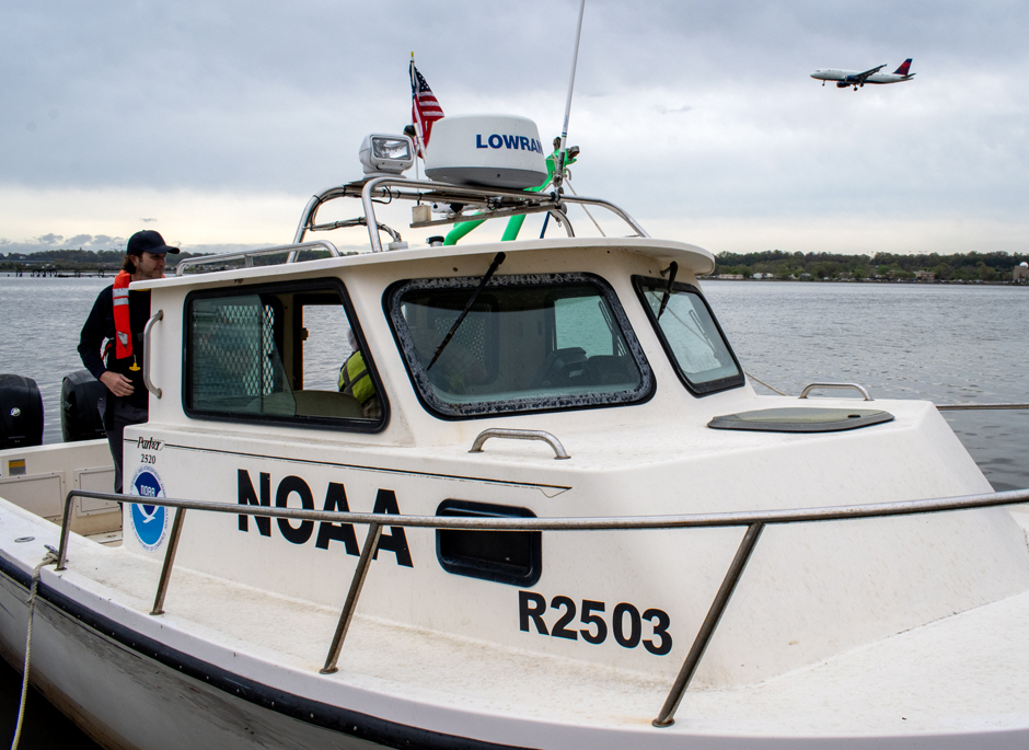
The CURBY on the Potomac River. It provided environmental observing support to aid teams working on-site. (Credit: NOAA CO-OPS)
NOAA’s CURBY Fleet
The buoy that was deployed was one of NOAA’s Real-Time Currents and Meteorological Buoys–known as CURBY.
Initially developed to support the National Current Observation Program, which produces tidal current predictions and other navigational safety products based on short- and long-term measurements, these pre-instrumented buoys have three broad purposes: “Science, navigational safety, and incident response.”
When dealing with the latter, the CURBY buoys are a valuable asset. Less than a year before the DCA crash, the Francis Key Scott Bridge collapsed into the Potomac River outside of Baltimore after a fatal strike from an out-of-control container ship.
In the aftermath, a CURBY system was deployed to aid navigation. Heitsenrether explains that, “because of the success of that deployment, we were called upon again to support the response from the DCA plane crash.”
The team retrieves the CURBY. (Credit: NOAA CO-OPS)
A Buoy Deployed at Pace
The NOAA team in Chesapeake, Virginia, was requested to pull an existing system and redeploy it in the Potomac. They worked quickly–“Within a day, we were able to build it out, test it, and then the next day, trailer it to DC,” Heitsenrether says.
The buoy payload consisted of a HydroMet SUTRON satellite data logger, Nortek Acoustic Doppler Current Profiler and an In-Situ Aquatroll 200 sensor to measure water conductivity and temperature. The Gill GMX560 marine grade weather station secured topside was a new addition, and this deployment was a valuable testbed for the upgraded CURBY.
There was also a tracking beacon to provide peace of mind in the unlikely cases of loss of power to onboard equipment or mooring failure.
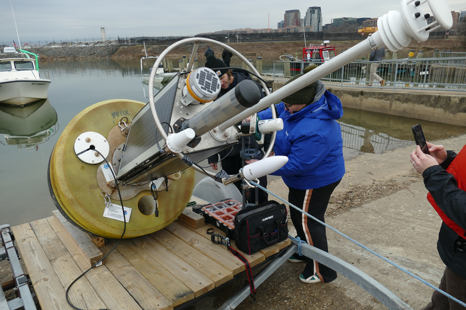
The team prepares to deploy the CURBY. Responding quickly, the team built out, tested and deployed the buoy within days. (Credit: NOAA CO-OPS)
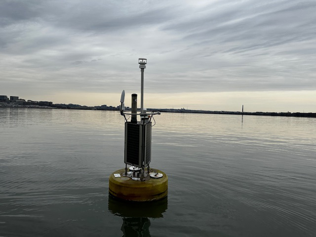
The CURBY in the Potomac River
Although the CB-950 is one of the largest in the NexSens offer, Heitsenrether highlights that the portability built into its design is an “important part of the story.”
“We have our payload up in the tower,” he says, “so it’s really easy [to deploy] if you don’t have a big boat with a lot of overhead lift. We basically take the buoy in pieces, put it together at a boat ramp, and then tow it out to the site using our small watercraft.”
Working with limited space alongside the Coast Guard and FBI from the public boat ramp at Gravelly Point, the buoy was deployed in the first week of February 2025.
The buoy worked in tandem with other systems and surveys to understand the crash site. Crucially, its data helped ensure divers were safe when investigating underwater targets.
“For recovery efforts when you’re in an area with relatively strong tidal currents, […] knowing the current profile and the weather conditions is very helpful for planning and executing various subsurface operations,” Heitsenrether elucidates.
The CURBY on the Potomac River. It provided environmental observing support to aid teams working on-site. (Credit: NOAA CO-OPS)
Better Data
The buoy remained in place on the Potomac River until April 2025, collecting data that was used for a variety of applications. As is common with most CURBY deployments, data has been shared with the public online at no cost, and its uses extend beyond its time and place of collection.
Heitsenrether explains, “That was a site where we didn’t have a permanent, real-time current meter as part of our network, so we plan to use that data to update local tidal current predictions.”
This deployment has also provided the CO-OPS team with further validation of the CURBY system’s durability and reliability.
“This was a newer version system than the one we first deployed at Francis Scott Key Bridge […] it was just another verification that this new system works in a different deployment,” Heitsenrether highlights.
“This was the first time this particular real-time CURBY system had to endure some harsh winter conditions, below freezing temperature with freezing rain,” he adds.
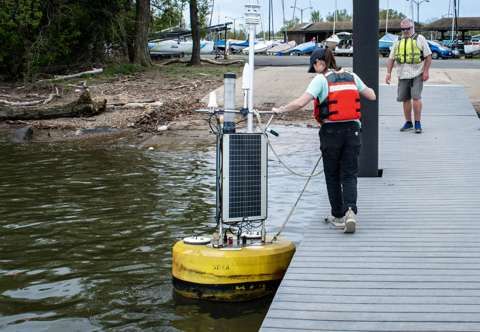
The team retrieves the CURBY. (Credit: NOAA CO-OPS)
The Future of CURBY
The deployment of the CURBY after the DCA crash demonstrates the critical role real-time oceanographic data plays in emergency response.
Heitsenrether explains that the CURBYs are a “slowly growing fleet”, and in addition to their usefulness in emergency response, they play an important role in research and navigational safety.
“The real time surface buoy that we have developed based on the NexSens CB-950 platform is becoming a critical component of that network for some applications,” he says, “in particular for measuring ocean current profiles and meteorological parameters.”
The growing potential of the CURBY fleet—and the valuable insights its data provides—signals a promising future for both emergency response and coastal science.
CURBYs have three main uses–science, navigational safety, and incident response. As is common with most deployments, data has also been shared with the public online at no cost. (Credit: NOAA CO-OPS)


0 comments