Real-Time Monitoring in Rhode Island: Narragansett Bay Fixed Station Monitoring Network
Narragansett Bay in Rhode Island has a long history of water quality issues resulting from land pollution, leading to the influx of nutrients into the bay, which can cause algal blooms and declines in dissolved oxygen. The resulting hypoxia and thermal stratification are of particular concern due to their impacts on the coastal fishery.
“To understand these shifts throughout Narragansett Bay, a small group of researchers were established in 1999 to monitor physical water quality parameters on a continuous basis,” explains Heather Stoffel, a marine research associate at the University of Rhode Island (URI) and Quality Assurance Officer for the Narragansett Bay Fixed Station Monitoring Network (NBFSMN).
Over the next several years, other agencies joined the project that became officially known as the NBFSMN in 2005.
The Rhode Island Department of Environmental Management (RIDEM), Narragansett Bay National Estuarine Research Reserve, Narragansett Bay Commission (NBC), and URI Graduate School of Oceanography (GSO) were the founding members of the project, with RIDEM’s Office of Water Resources (RIDEM-OWR) taking the lead.

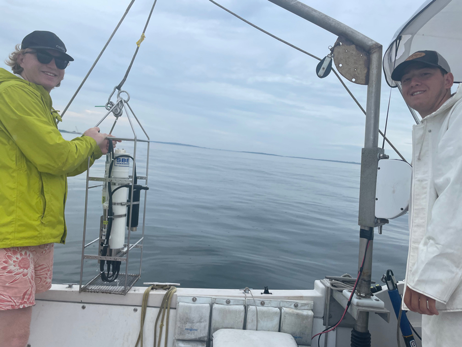
Darryl Sirleaf (NBC, left), Rich Balouskus (RIDEM Principal Marine Biologist, middle), Pat Brown (RIDEM Chafee Captain, right). Installing an acoustic receiver on the North Prudence Buoy in Narragansett Bay during buoy deployment (2022). (Credit: Heather Stoffel)
Evolution of the Narragansett Bay Fixed Station Monitoring Network
Starting in 2005, the OWR and its partners deployed multiple buoy monitoring stations in the bay with a focus on the areas prone to hypoxia and other pollutants.
In 2008, the Sally Rock Buoy was added to increase spatial awareness of water quality in Greenwich Bay, an area of concern for several water quality issues.
Then, in 2016-2017, two new buoys were added in Mount Hope Bay at Taunton River and Cole River as the Massachusetts Department of Environmental Protection joined the project. Between 2019 and 2024, several aging stations were replaced and/or upgraded. These upgraded buoy systems are NexSens CB-650.
At the same time, two land-based stations (Greenwich Bay and Graduate School of Oceanography (GSO) Dock) were upgraded using NexSens data loggers to incorporate YSI EXO2 sondes and SUNA V2 nitrate sensors at each station. These upgrades were funded through the New England Regional Coastal Ocean Observing Systems (NERACOOS), designed to look at nutrient levels throughout the New England region.
Currently, 14 monitoring systems are stationed throughout Narragansett Bay—10 near real-time data buoys and 4 dock-mounted systems that continuously collect water quality data. Stations are concentrated in the upper bay for increased coverage in the more impacted region.

Photo of NexSens data logger and instruments (EXO2 and SUNA V2) held by Mike Potter, Marine Research Assistant at URI/GSO. (Credit: Thomas DiChiaro, undergraduate URI)
Three of the upper bay stations (North Prudence, Conimicut Pt and Poppasquash Pt) utilize the NexSens CB-650. “These buoys allow for quick reporting in areas prone to intermittent hypoxia during the summer,” states Stoffel.
The goal of the NBFSMN is to provide data to analyze the spatial and temporal distribution of hypoxia in Narragansett Bay. The data from this network is combined with other sources of data to assess the extent of seasonal hypoxia in the bay and guide nutrient management and emergency response.
“RIDEM-OWR is working with its partners to continue a comprehensive and coordinated monitoring program to analyze the spatial and temporal distribution of low oxygen in Narragansett Bay during the summer,” states Stoffel.
She continues, “The information from the NBFSMN is used for event-based reporting (storm events), low oxygen events/fish kills, assessment coastal management decisions related to water quality (i.e. eutrophication issues), climate change issues related to species distribution, coastal acidification, harmful algal blooms, and environmental quality trends over time.”
Wendell Swan and Thomas DiChiaro (URI undergraduate students) conducting a spatial survey using Seabird 19plus in Narragansett Bay. (Credit: Heather Stoffel)
Data Collection in Narragansett Bay
Each of the real-time monitoring stations is equipped with a YSI EXO2 sonde measuring temperature, salinity, dissolved oxygen, depth, pH, and chlorophyll at different depths. Select locations include a SUNA V2 nitrate sensor.
The integrated NexSens data logger transmits water quality data via cellular data every 15 minutes to a secure computer at the Marine Ecosystem Research Lab at the University of Rhode Island’s Graduate School of Oceanography.
“From there, real-time data is made available to the Northeastern Regional Association of Coastal Ocean Observing Systems (NERACOOS),” explains Michael Potter II, a marine research specialist at URI.
Stoffel adds, “Scientists can track current conditions, conduct additional sampling during hypoxic events, and report findings to managers and the public.”
Once the data passes a quality assurance evaluation, it is made available to the public via the RIDEM website.
The network has been collecting data for 20 years, which is all stored within a historical dataset that makes trend spotting easier. These sentinel stations can help identify monitoring gaps and help prioritize monitoring needs.
For example, the network stations can be utilized in the future as test sites for newer monitoring technologies, such as innovations in oil pollution monitoring and PFAS detection.
In the future, the NexSens-based platforms will allow for instrument expansion, helping to fill these data gaps and address the needs of managers and others. The NBFSMN is expected to remain a fundamental component in monitoring event-based, as well as long-term, changes in Narragansett Bay.
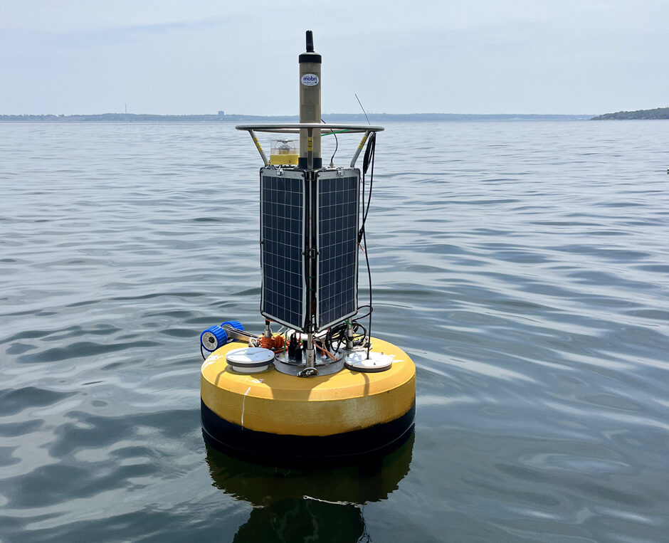
Poppasquash Buoy 2025. (Credit: Kathryn Staebler, graduate student at URI/GSO)
The Importance of Monitoring Narragansett Bay
Tracking such changes is essential to the protection of the bay. The coastal region provides an estuarine environment for many northern and southern species, including commercially protected species such as lobster, striped bass, quahogs, black sea bass, whales, and dolphins.
Now is a particularly important time for monitoring to continue due to changes in wastewater management. Wastewater treatment facilities within the Narragansett Bay watershed were a leading cause of nutrient pollution in the bay for decades, leading to increased algal blooms that decay and consume dissolved oxygen, resulting in hypoxic bottom waters.
Recent upgrades to wastewater operations in both Rhode Island and Massachusetts have achieved about a fifty percent (50%) reduction in the total loading of nitrogen into Narragansett Bay since the early 2000s.
“With the significant reduction in pollutant loadings and the influence of climate change, bay water quality conditions are expected to continue to change as well,” states Stoffel.
She adds, “Having long term monitoring stations such as the NBFSMN operational for the foreseeable future is imperative to provide accurate information to assess these changes from management as well as climate driven changes.”
While the data has scientific and management uses, Stoffel also stresses the importance of the data to the public.
“This information supports research, management, teaching opportunities, and public information on health conditions within Narragansett Bay. Any gaps driven by lack of support will hinder managers ability to determine changes to the estuarine environment of Narragansett Bay ecosystem,” states Stoffel.
While progress has been made to reduce point-source pollution into the bay, the threat of runoff from agricultural and urban areas continues to impact water quality. Data collected by the network plays an important role in informing future land use and coastal communities of nearshore conditions as a means of disaster mitigation.
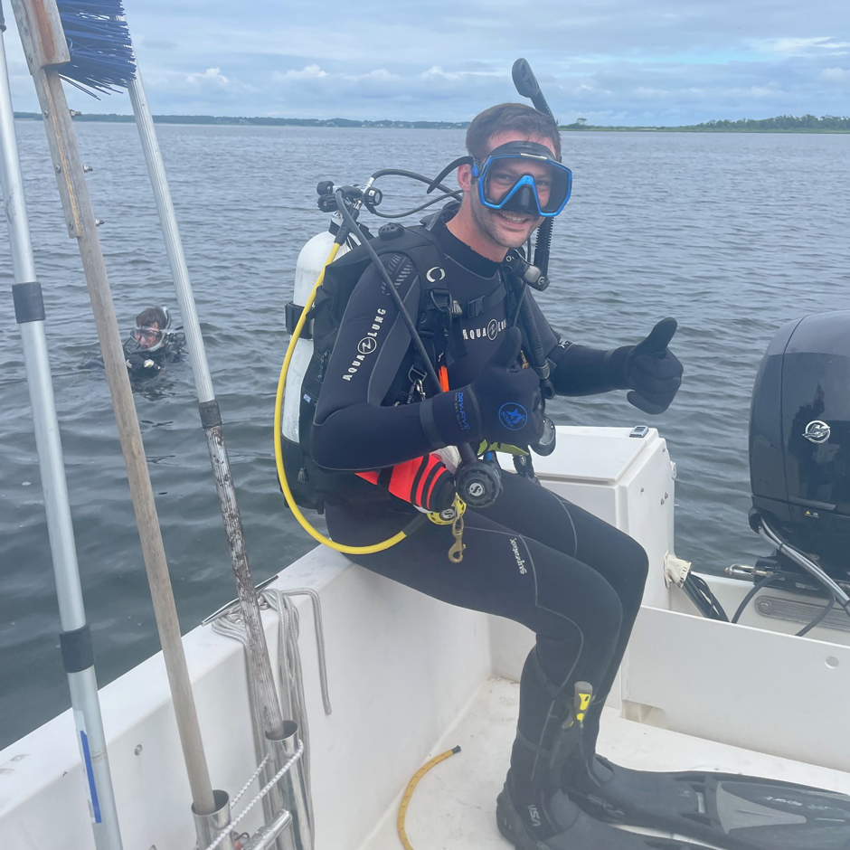
Mike Potter (on boat) and Vinny Deingeniis (URI-graduate student) diving on North Prudence buoy for inspection during summer 2024. (Credit: Heather Stoffel)


0 comments