Smaller Buoys Fill In The Gaps of Coastal Hurricane Monitoring Networks
As hurricane frequency and severity continue to increase, real-time monitoring along the coast has become more and more important to disaster mitigation and developing forecasting models.
In response to this, coastal observation networks across the United States have been deploying data buoys to collect data continuously, building a more comprehensive dataset of conditions that lead up to hurricanes as well as documenting conditions during and after storms.
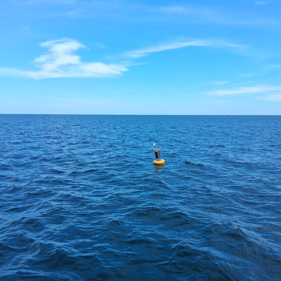
Successful deployment of the West End – Compass Port (WE-CP) buoy approximately ~9 miles south of Katrina Cut, Dauphin Island, AL, in the Mississippi Bight. (Credit: Brian Dzwonkowski)
Monitoring Water and Weather Conditions in the Mississippi Bight
As is the case in the Mississippi Bight, where Brian Dzwonkowski and AJ Stewart from the Dauphin Island Sea Lab and the University of South Alabama have deployed a NexSens CB-650 data buoy to monitor weather and water quality conditions in the coastal regions of Alabama and Mississippi.
A Gill MaxiMet 500 measures air temperature, humidity, pressure, and wind, while a Sea-Bird HydroCAT records conductivity, temperature, pressure, and dissolved oxygen. A NexSens X-series data logger transmits this data to the cloud, where Dzwonkowski and collaborators can view data in real-time.
While the system has only been collecting data for a few months, data from the buoy will be used for a variety of things, ranging from local and regional alerts to public decision-making, developing forecast models, and advancing current understandings of coastal ocean dynamics.
For example, groups like the National Weather Service have a particular interest in data from the system, as they have been interested in being able to observe wind and wave data at a larger scale. Similarly, other regional groups are interested in the same data for rip current forecasting models.
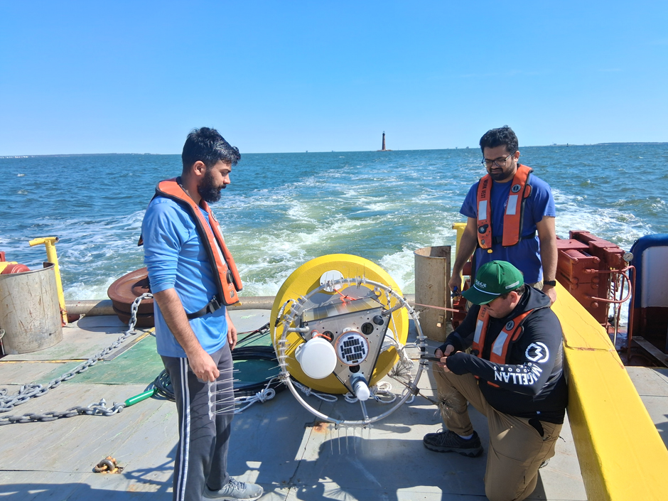
AJ Stewart, Dauphin Island Sea Lab Technician, affixing bird spikes to the buoy tower. (Credit: Brian Dzwonkowski)
The location of the system is also unique, stationed right at the edge of the Mobile Bay river plume, which is a shallow lens of relatively fresh water that’s “ejected out of Mobile Bay just about every tidal cycle.”
“The surface measurements from the buoy gives us a better understanding of how far that plume is getting offshore, how often it hits the site, and the relative stratification that it’s producing,” states Dzwonkowski.
The data can be publicly viewed via the Alabama Real-Time Coastal Observing System (ARCOS) and the Gulf of America Coastal Ocean Observing System’s (GCOOS) data portal.
GCOOS was the main sponsor for this project and supported the purchase and deployment of the system. The GCOOS data is then pushed to the National Data Buoy Center, where the data can be accessed by the public.
While the data is still relatively new, Dzwonkowski is interested to see how national groups adapt and use the data to look at hurricanes and other tropical cyclones that have come into the bay area or have a near landfall track.
“Sea surface temperature is an important measurement for understanding the heat flux from the ocean to the storm when these storms are making landfall,” explains Dzwonkowski.
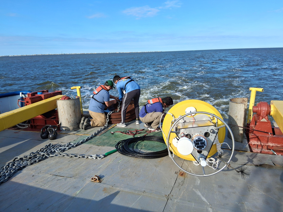
University of South Alabama graduate student, Aravind Puzhankara, and Dauphin Island Sea Lab technician, AJ Stewart, securing the anchor chain on the way out to the deployment site. (Credit: Brian Dzwonkowski)
Challenges to Hurricane Monitoring on the Coast
While offshore data collection has expanded in the wake of the growing need for data in response to the rise in tropical storms, a leading limitation of additional systems is cost.
In general, oceanographic buoys tend to be very large and expensive, both from an initial purchase perspective as well as the additional costs of deployment and maintenance.
The cost barrier to the larger buoys is what inspired Dzwonkowski to deploy the CB-650 on the continental shelf, offering a more cost-effective solution that balances size, robustness, and data collection without breaking the bank.
“Those large-scale buoys can be hundreds of thousands of dollars depending on the instrument arrays, and then you also need a boat that costs $10,000 a day to service it, and giant anchors. It’s a tremendous amount of investment in time and energy, and you also need a significant-sized team to be able to do that kind of operation,” states Dzwonkowski.
He continues, “The hope [with the CB-650] is that with a smaller scale buoy, we can handle it with a smaller boat, and we can run out to it, service it, switch instruments— do the things we need to do at a much lower cost.”
Dzwonkowski notes that, while of course, the smaller buoys come with their own risks if hit directly by a hurricane, the 3-meter oceanographic buoys can also be damaged or destroyed, and cost significantly more to replace and repair.
He explains, “We’re sort of playing the odds a bit here. And so, if we just get a glancing blow from a hurricane, maybe it’ll be alright. Either way, the cost is much, much lower than what would be required to constantly maintain a long-term oceanographic buoy at this location.”
So far, the CB-650 data buoy has performed well under usual conditions.
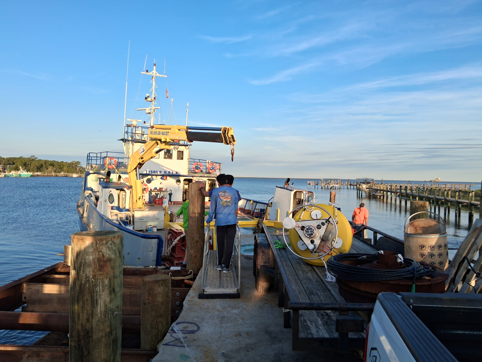
Preparation for the buoy deployment off the Tyson B on Dauphin Island, AL. (Credit: Brian Dzwonkowski)
Future Expansion and Ensuring Continuous Data Collection
While there aren’t plans to expand to additional sites at the moment, Dzwonkowski hopes that the program can be expanded to include the purchase of at least two additional systems, as these would allow the team to swap the buoys out for longer-term maintenance, minimizing data gaps.
“The idea is that you have one in the water, one that gets swapped out, and then one sitting on the shelf that’s ready to go if one is being repaired. That way you’re not waiting on parts and things of that nature with something out of the water.” he explains.
Dzwonkowski stresses that a deployed system, with two backup systems, is the best way of ensuring that there aren’t gaps in the data if the original system needs to be removed from the water for any reason, including standard maintenance.
For now, though, Dzwonkowski plans to leave the system deployed for as long as possible to ensure that the public and regional stakeholders can continue to use the data.
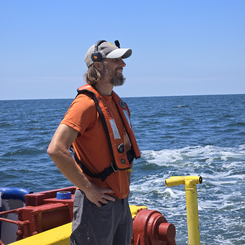
Project PI Brian Dzwonkowski thinking, “Boy, I hope this goes smoothly!” (Credit: Dev. R.M. Rao)


0 comments