Texas’s Gulf Coast Demands More Research: USGS Scientists are Answering the Call
Along the thousands of miles of ocean coastline cradling the American South lies the popular beach town of Galveston, Texas. While tourists flock to the sandy shorelines and historic piers, another world exists right alongside them–one full of scientists who are adamantly monitoring the Gulf of America, hoping to understand this economically and biologically vital water body amid changing environmental conditions.
Contributing to this work is the US Geological Survey’s (USGS) Oklahoma-Texas Water Science Center (OTWSC). Joined from two separate state centers in 2020, but tracing its rudimentary roots back to the late 1800s, the center has been studying and measuring water in the region for over a century.
The USGS Oklahoma-Texas Water Science Center’s Gulf Coast Branch is located just north of Houston, but with such a large coastline along the Lone Star State, considerable focus is given to coastal water quality monitoring. This is the world of Hydrologist Luke Travis, who has his hands in projects from Lake Sabine down to Corpus Christi, Texas.
“The Gulf is relatively under-researched considering its size and economic importance — especially in regards to ocean coastal acidification,” Travis says.
From national monitoring systems to local flood watches, the USGS center is striving to better understand the world’s largest gulf.
Luke Travis collecting sediment samples from the Cowlitz River near Castle Rock, WA, during a training. (Credit: Justin Boldt / USGS)
Monitoring Coastal Ocean Acidification in the Gulf
One research project conducted by the USGS is the Ocean and Coastal Acidification project in cooperation with the Gulf of America Coastal Ocean Observing System and the Galveston Bay Estuary Program.
As part of this project, the USGS operates continuous monitoring in Tampa Bay, Florida, and is preparing to deploy a station in Galveston, Texas, this year, according to Hydrologist Zulimar Lucena.
Coastal and Ocean acidification occur when carbon dioxide levels in the atmosphere start rising. The ocean acts as a sink, absorbing the carbon and thereby lowering its pH level.
This phenomenon is harmful to many aquatic organisms, especially those that rely on calcification to create protective shells. Travis explains that this includes shellfish, which are a substantial source of economic impact around Galveston Bay.
“It’s very, very important to establish a baseline understanding of what the [level of] acidification is,” Travis says. He explained that understanding pH and temperature fluctuations is key to evaluating how ecosystems respond to changes.
To monitor coastal ocean acidification, the USGS is installing a site in Galveston to monitor pH, partial pressure of carbon dioxide, dissolved oxygen concentration, temperature, and specific conductance. Travis explains that all instruments will be housed in a single box, where water is taken in, measured, and then flows out.
The Galveston station will be installed within a year to expand on existing ocean and coastal acidification monitoring along the Gulf Coast, which includes stations in Tampa Bay, Florida, Coastal Louisiana, and the Mission Aransas Estuary in Texas.
Travis says that field samples will be ongoing to validate sensor readings. Field samples will include discrete measurements of pH, dissolved inorganic carbon, and total alkalinity. As atmospheric carbon dioxide levels rise, and the Gulf continues harboring both biodiversity and commercial fisheries, understanding how the water body responds to coastal ocean acidification is crucial.

Two USGS employees, Robert Ellis and Jonathan Mills, collecting sediment samples from the Trinity River near Wallisville, TX. (Credit: Zulimar Lucena / USGS).
Coastal Monitoring to Create Models
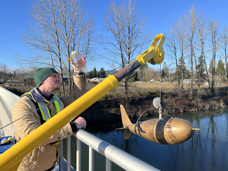
While the project gets up and running, Travis still finds himself out in the field, monitoring data buoys up and down the Texas coast. He explains that this coastal monitoring project involves twelve sites, half of which monitor temperature and specific conductance, while the other six also measure pH as a third parameter.
In cooperation with the Texas Water Development Board, which has installed NexSens CB Buoys at various sites, Travis often travels to one or two locations a week, swapping out monitoring tools and checking in on the sites as they continuously record.
The real-time data collected from the buoys is synthesized by the USGS and used by the Texas Water Development Board to create hydrology and hydrodynamic models. The USGS hydrologists appreciate the value that long-term monitoring provides to scientific organizations, especially when they undertake complex modeling tasks.
“A long, robust, real-time dataset is very useful for examining trends and provides a solid foundation for various kinds of modeling efforts,” Lucena says.

Luke Travis swapping out a water quality monitor located on a NexSens buoy in West Galveston Bay. (Credit: Mackenzie Mullins (USGS)
Water Quality Monitoring in Houston
Beyond coastal monitoring, the USGS Oklahoma-Texas Water Science Center also provides scientific information to Houston and its metropolitan population of over 7 million people. From measuring sediment concentrations from Galveston Bay’s tributaries to monitoring the city’s drinking water supply in Lake Houston, the USGS delivers actionable information relevant to decision makers.
“In a city as big as this, it’s important to study and collect data on the water, which can help resource managers make informed decisions.,” Travis says.
Meanwhile, the stations also monitor water flowing from city waterways into Lake Houston. Using YSI EXO3s, they monitor temperature, specific conductance, pH, dissolved oxygen, and turbidity.
By determining when water quality may change in tributaries, Travis says that water treatment plant operators are able to receive early warning on potential changes to the water quality of the lake.
On the other hand, Houston often faces another water problem: natural disasters. Located almost entirely in a low-lying floodplain and extremely close to the coast, the city is especially susceptible to intense floods and tropical storms.
The USGS center monitors water level gauges and measures discharge rates constantly, providing invaluable information to public officials and citizens should a disaster occur.
“USGS streamgages measure water levels and flow to help emergency managers make decisions that keep people safe during floods,” Travis says. “All of this critical safety information is available free to the public.”

Picture taken of Sabine Lake while on a USGS boat. (Credit: Luke Travis)
Investigating Microplastics in Galveston Bay
Even with projects all across the nation’s second-largest state, the Oklahoma-Texas Water Science Center continues expanding its cutting-edge research. One of its newer endeavors involves investigating the presence of microplastics in Galveston Bay.
Microplastics are a hot topic across scientific disciplines, and new methods are constantly being tested to understand them. In Galveston, Travis says they are attempting to extract the tiny contaminants from water samples, hoping to gain baseline data about the problem.
“We work with the Oklahoma Microplastics Research Consortium at the University of Oklahoma to do the analysis of those samples,” Travis says. “And it’s such a cutting-edge science right now, trying to figure out the best method for extracting and identifying the microplastics.”
This project is wrapping up, and while the center doesn’t yet have results, the center expects them soon. As is the case with nearly all the data the USGS produces, the results from the microplastics study will be available for anyone to see.
“We hope it’ll be of benefit to the public and to stakeholders to have available information on the extent of microplastics contamination in the Galveston Bay watershed,” Lucena says.

Approaching a NexSens buoy in Galveston Bay. (Credit: Luke Travis)
Public and Unbiased Data
A common theme among most USGS projects is sharing their results and monitoring with the public. Travis explains that he and his colleagues are scientists, not decision-makers, who work to ensure that resource managers, emergency officials, and other stakeholders have access to accurate and reliable data.
“As an unbiased science agency, our role is to collect and provide high-quality data,” Travis says. “We follow rigorous scientific methods to ensure the information we provide is accurate and objective, so decision-makers can rely on it when making choices that affect communities and natural resources.”
While not everyone may want to learn about ocean acidification, these data will continue to be available for those curious enough to explore the water impacting their daily lives, especially as the Gulf continues growing into an important water body. And when a disaster threatens to strike, public data becomes that much more important.
“It’s important for the public to recognize that this data is both valuable and freely accessible for public use,” Travis says.

A water quality profiler located in Lake Houston. (Credit: Luke Travis)


0 comments