Watching a Freshwater Sea: Monitoring Change on Wisconsin’s Shipwreck Coast
For over 10,000 years, people have used the Great Lakes and their waterways–which connect over 1,000 miles of North America–for transport, trade, exploration, and subsistence.
The Great Lakes are so large that they act like a sea, generating their own weather patterns, tempestuous waves, and causing significant coastal erosion. Unsurprisingly, traversing these waters has never been without risk, and an estimated 6,000 vessels found their final resting place beneath the five lakes’ wave-crested surfaces.
The Wisconsin Shipwreck Coast National Marine Sanctuary (WSCNMS) covers 962 square miles extending from Wisconsin’s Port Washington to the city of Two Rivers, and is home to 39 known shipwrecks–some preserved almost completely by virtue of Lake Michigan’s cold water.
While technology makes navigating the Great Lakes today much safer than when mariners relied on sails and sextants, until recently, there were big gaps in our knowledge of real-time water conditions.
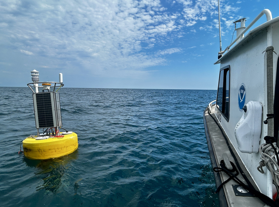
Data from the Shipwreck Sentinel contributes to long-term records that help identify patterns and trends. (Credit: Caitlin Zant)
Understanding a Variable Environment
Jessie Grow is a Research Specialist at the University of Wisconsin-Milwaukee School of Freshwater Sciences (UWM-SFS).
Grow is part of a collaborative effort by UWM-SFS and NOAA working on the Wisconsin Shipwreck Coast Sentinel project in Sheboygan, Wisconsin. It aims to deploy a real-time system to improve forecasting, support public safety decisions, and provide insights for researchers.
Grow explains, “Nearshore conditions in mid-Lake Michigan can change quickly, yet historically there have been few site-specific, continuously operating observing platforms in this region.”
In 2023, a grant from the Fund for Lake Michigan helped expand the Wisconsin Shipwreck Coast Sentinel project.
In 2022, WSCNMS started a pilot project that demonstrated the need for real-time lake data. The initial system used during the pilot comprised three small, “smart moorings” deployed within the WSCNMS and equipped to provide real-time wind, wave, and water temperature measurements.
“While these buoy systems have helped improve overall coverage and confirmed strong user engagement,” Grow says, “Their design limits the types of measurements they can support, including water quality and current profiles. Additionally, some parameters are estimated rather than directly measured.”
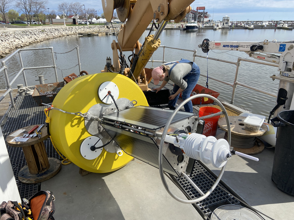
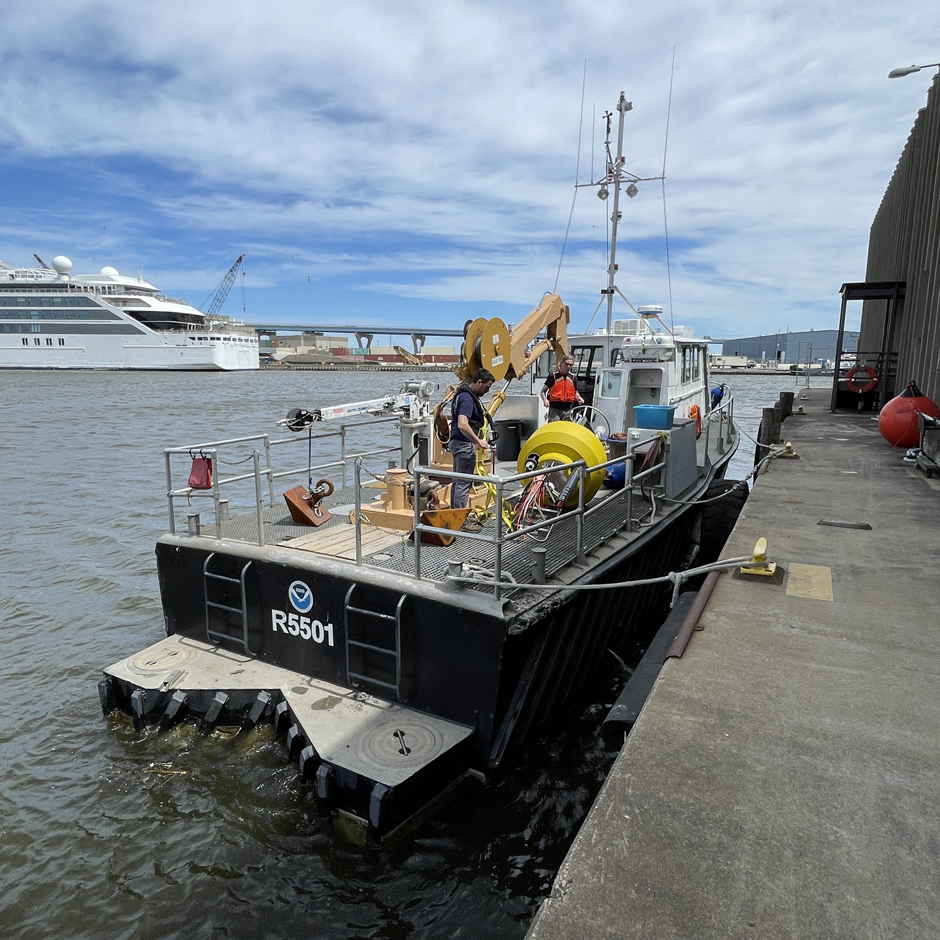
Preparing the Shipwreck Sentinel for deployment. (Credit: Caitlin Zant)
Wisconsin Shipwreck Coast Sentinel
To address these limitations, the “Shipwreck Sentinel” buoy was developed, with the specific aim of developing a system that was robust and instrument-rich–“complementing existing systems while providing higher-resolution, long-term data needed for research, forecasting, and stewardship.”
As lead buoy technician, Grow’s primary responsibilities are to lead the design, integration and maintenance of buoys and their sensor loads to ensure reliable real-time data collection.
She quickly identified the NexSens CB-950 buoy as the most suitable deployment platform. Grow highlights, “I am very familiar, comfortable, and confident in their design and ruggedness. I have said previously that these buoys can withstand time and tempest, and I stand by that claim.”
She adds, “They are designed specifically for continuous, unattended monitoring in open water environments and can reliably transmit data over cellular and satellite networks.”
The Shipwreck Sentinel is equipped with a NexSens X-series data logger with a custom-designed lid that incorporates the logger, sensor connectors, wave sensor, and battery connectors all in one unit.
It has been configured with a Lufft weather station, a SeaView wave sensor, a YSI EXO2 water quality sonde, a Nortek Acoustic Doppler Current Profiler (ADCP), and a NexSens T-Node thermistor string.
Despite carrying a full sensor suite, Grow emphasizes the ease of integrating the Sentinel with the wider fleet because of the “standardized NexSens configurations, components, and system design.”
The Sentinel is deployed seasonally alongside the existing smart moorings, and together, they cover over 70 miles of coastline.
Located in around 37m of water, Grow says, “We use a two-point mooring style to ensure directional data like wind and wave direction can be easily quality controlled by expecting a fairly consistent sensor heading, as well as ensuring the temperature string is positioned safely between the mooring cables and chains.”
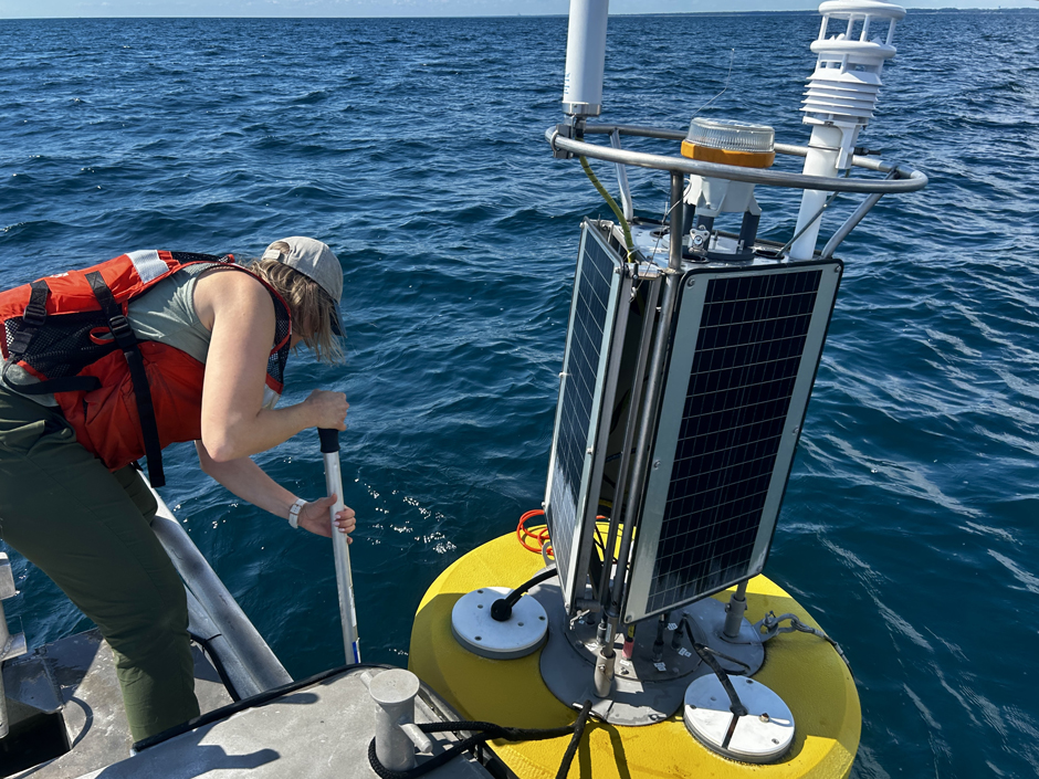
The Shipwreck Sentinel is deployed seasonally alongside existing smart moorings. Together, they cover over 70 miles of coastline. (Credit: Caitlin Zant)
Targeted Data Collection
In contrast to traditional ship-based sampling or static shoreline sensors, buoys provide regular, autonomous data collection, and can be deployed strategically and flexibly–where getting accurate data on conditions matters most.
“These systems provide real-time observational data that directly addresses the lack of localized measurements in mid-Lake Michigan,” Grow explains.
Collected data is transmitted to the Great Lakes Observing System (GLOS), where it is compiled and made publicly available via the Seagull platform.
“Wind speed/direction, wave height and direction, and water temperature data contribute to more accurate forecasting and better situational understanding for stakeholders, including the National Weather Service, recreational users, commercial operators, and emergency response planners,” Grow states.
“This new system provides timely, location-specific measurements that improve forecast accuracy for small craft advisories and wave hazard warnings. The real-time nature also supports public safety decisions in ways that sporadic sampling cannot.”
Data also contributes to long-term records that help identify patterns and trends relevant to environmental research, public safety, and an understanding of how conditions near historic wreck sites are evolving.
Furthermore, the platform is evolving to meet user needs. This season, Grow is working with members of a local fish club who would like to support the addition of a NexSens surface camera on the buoy.
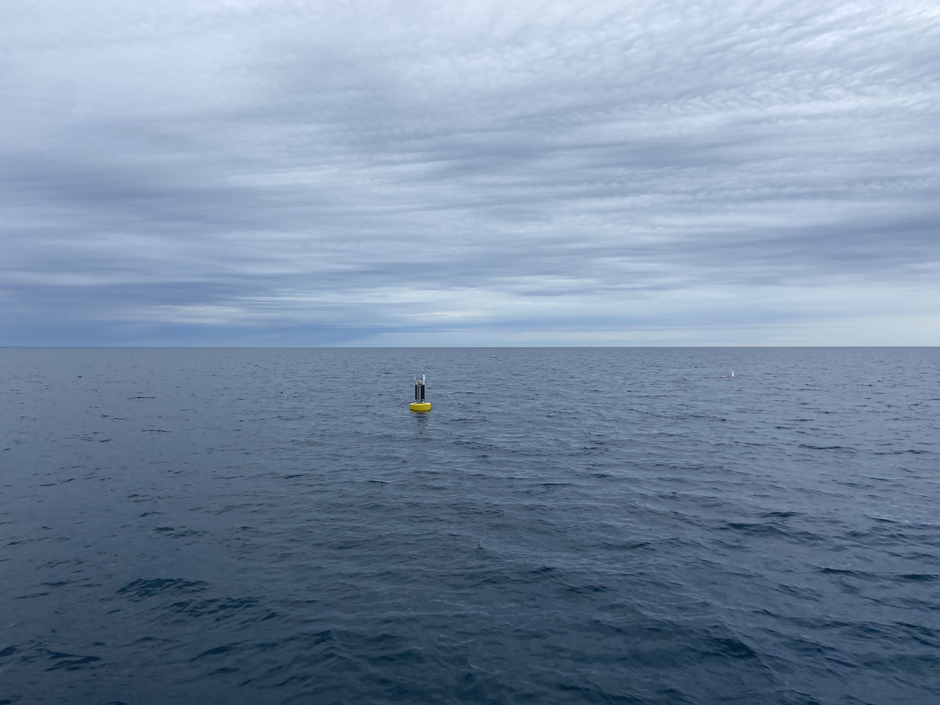
The Great Lakes are so large that they act like a sea and generate their own weather patterns–part of the reason these waters now hold such large numbers of shipwrecks. (Credit: Caitlin Zant)
Other Insights and the Future
Regular trips out on the water to conduct routine buoy maintenance have highlighted the dynamism of the local current profile. Grow remarks, “Currents appear to vary significantly over short time and spatial scales.”
Data from the Sentinel’s ADCP will be able to shed more light on this variability once it has been fully evaluated, and Grow notes that this observation has “reinforced the importance of sustained, site-specific monitoring and informed future plans to better characterize nearshore currents in this area.”
Looking ahead, the project’s emphasis is on continued seasonal deployments with incremental improvements in sensor suites and integration with additional modeling efforts.
Just as importantly, maintaining this type of observing system requires sustained operational support. Grow explains, “Continued collaboration with NOAA, GLOS, and other partners is focused not only on scientific advancement, but also on securing long-term maintenance and operations funding to ensure the buoy remains a reliable, accessible public resource for years to come.”
As long-term records grow, so will the possibilities of deeper research into nearshore dynamics and improvements in predictive capabilities–to inform both safety and scientific communities.
Grow is inspired by the tangible value of this data–“These systems turn uncertainty into situational awareness,” she says.
She continues, “Filling a data gap that existed in mid-Lake Michigan prior to their deployment. That kind of tangible contribution to safety and science–along with maintaining a direct university-to-community connection–is what has always inspired me about this work.”
The Wisconsin Shipwreck Coast Sentinel project in Sheboygan, Wisconsin, is a joint effort by UWM-SFS and NOAA. (Credit: Jessie Grow)


0 comments