Muskingum Watershed Conservancy District Deploys Five New Real-Time Data Buoys
Water resource management in the Muskingum River Watershed dates all the way back to 1913, when a record-breaking flood devastated the area. The event became known as the Great Flood of 1913, resulting in 650 residents dead and miles of damaged land.
In hopes of minimizing the impact of future floods, the Muskingum Watershed Conservancy District (MCWD) was formed. Focused on flood control and water conservation, 14 dams were constructed throughout the watershed over the following years.
These dams created reservoirs that continue to play an important role in flood management, but have also become recreational hubs for residents and visitors. As such, monitoring of the reservoirs has become an important responsibility of the district to ensure public safety and conservation of the resource.
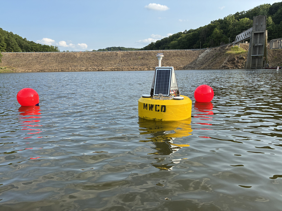
Data buoy PH-01 deployed on Pleasant Hill Lake. (Credit: Bailey Miller / MWCD)
Water Quality Monitoring in the Muskingum River Watershed
Historically, the district has done spot sampling for E. coli and nutrient levels, as well as using YSI EXO sondes to measure temperature, pH, turbidity, and dissolved oxygen, at various sites in the watershed. And while the data is time-stamped, Bailey Miller—Conservation Technician for MCWD—notes that “they are not truly real-time.”
She explains, “The E. coli tests take several hours to yield data, and the data collected by the sonde systems are only during the short time that we are at each lake during the week.”
In hopes of getting a more complete picture of how some of the district’s most popular lakes—Charles Mill, Pleasant Hill, Atwood, Tappan, and Senecaville—fluctuate over time, the MCWD deployed five NexSens CB-450 data buoys in 2025.
Each buoy is equipped with a YSI EXO2s sonde for measuring turbidity, temperature, dissolved oxygen, pH, blue-green algae, specific conductivity, chlorophyll, and fDOM data about one meter below the surface.
Additionally, each system has a T-Node FR temperature string that measures temperature data every meter and an In-Situ RDO-BLUE that measures dissolved oxygen at the surface and right above the lakebed.
“My personal favorite is the sensor string; I really enjoy watching the changes in the data as the lakes stratify and mix throughout the season,” adds Miller.
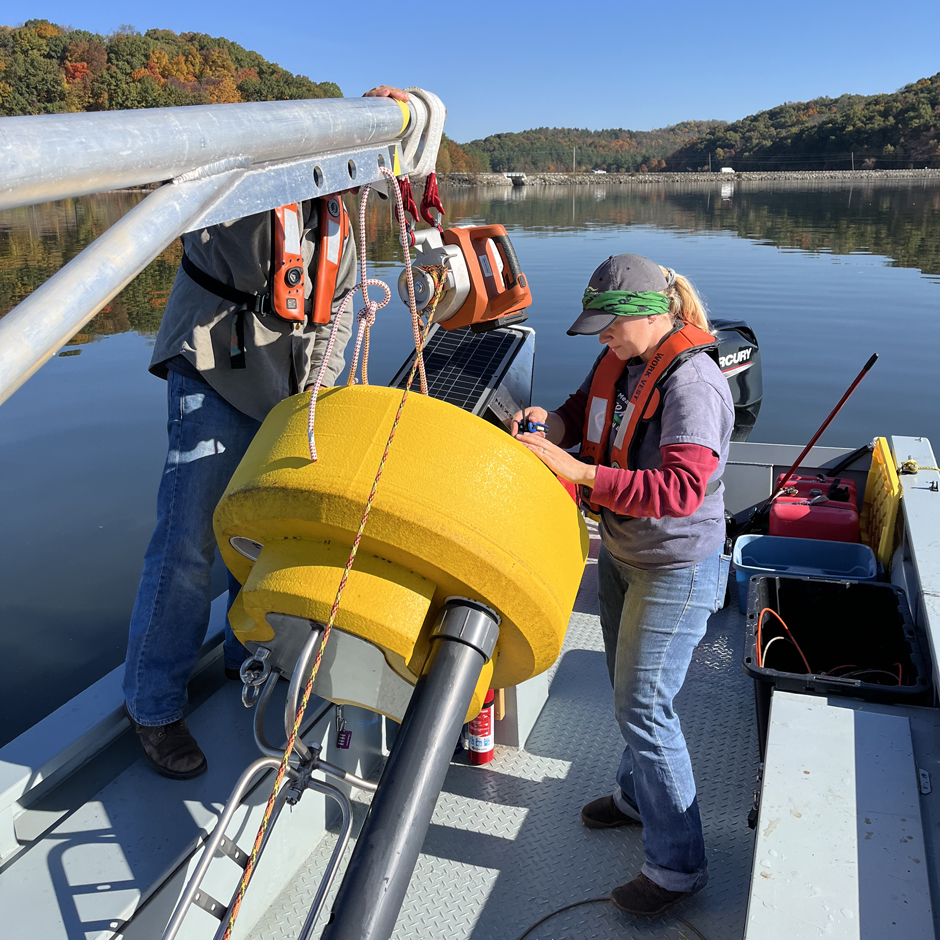
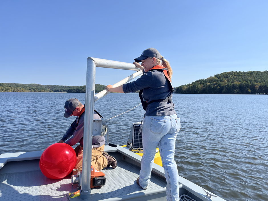
Matt Thomas and Kathryn Hamman activating sensors on data buoy TN-01 before it is deployed at Tappan Lake. (Credit: Bailey Miller / MWCD)
The buoy in Atwood Lake is specially equipped with a weather sensor that records air temperature, wind speed, and wind direction. The addition of the weather station at Atwood served two functions,
First, the weather station provides a different perspective on water quality and climate conditions that impact it. Second, Atwood Lake was chosen because a local sailing club often launches near the buoy site.
“So even if the weather data did not help us in the way we envisioned, they would still be useful in helping the sailing club,” shares Miller.
Data from each of the systems are streamed to WQData LIVE, where Miller, the rest of the team, the public, and various stakeholders can view the data in real-time.
“We’re very excited to make all of this data available to the public as a free and easily accessible resource for anyone to learn more about our watershed,” explains Miller.
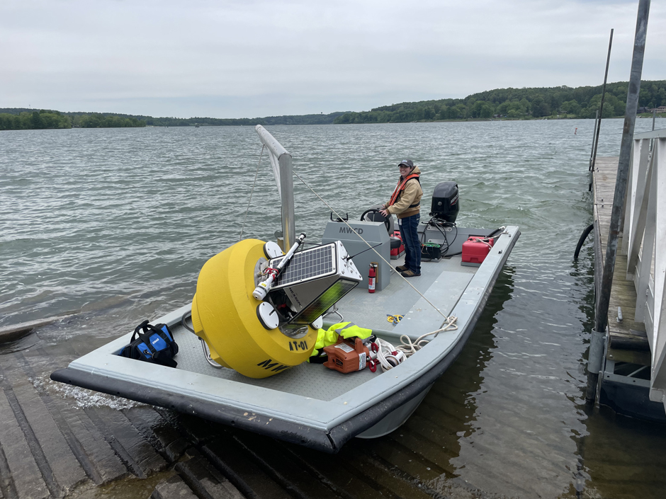
Bailey Miller on RV Beaver at Atwood Lake, preparing to deploy data buoy AT-01. (Credit: Matt Thomas / MWCD)
Why Real-Time Data?
According to Miller, adding the real-time data buoys to the district’s ongoing spot sampling efforts was decided for a few reasons. “For starters, the continuous stream of data allows us to build a more complete profile of each of our lakes more easily than other methods,” she begins.
Second, the Conservation Department that manages water quality monitoring efforts is small for the size of their district—covering eight lakes spread across more than 8,000 square miles—“So anything that allows us to cover more area is a huge asset,” continues Miller.
Finally, the ability to quickly share data with partner agencies, universities, and the public is a key part of the district’s focus on public safety.
“The live data allows potential beachgoers to decide if the water is warm enough to swim and gives fishers insights into what species of fish are likely to be active,” she explains. “These real-time systems have supplemented our own data collection, as well as our ability to share data between departments and with outside agencies.”
Matt Thomas and Bailey Miller deploying data buoy CM-01 from RV Beaver on Charles Mill Lake. (Credit: Brooke Williams / MWCD)
New Opportunities for Collaboration
The data is not only helping to build a more complete profile of each of the lakes, but also a key piece to addressing water quality concerns throughout the district.
“This system allows us to see and showcase how our lakes change throughout the year, which helps both the MWCD and others make more informed decisions regarding management, research, and recreation,” states Miller.
Based on the success of the buoys so far, Miller shares that the district is planning to expand the project to the three remaining reservoirs—Piedmont, Clendening, and Leesville Lakes—over the next few years. Additionally, the district plans to add weather stations to the current and future systems to improve public safety and expand the capabilities of the buoys.
The potential of this data is vast, with hopes of building a database on the MWCD-managed lakes as well as recording trends in how the lakes change over time and in response to different events, like heat waves and extreme weather.
The buoys also represent a new opportunity for collaboration between agencies, universities, and MWCD—providing key data that can supplement research, modeling, and other endeavors.
“This project is on the cutting edge of research in the region, and it’s an exciting opportunity to play a role in shaping the path forward,” concludes Miller.
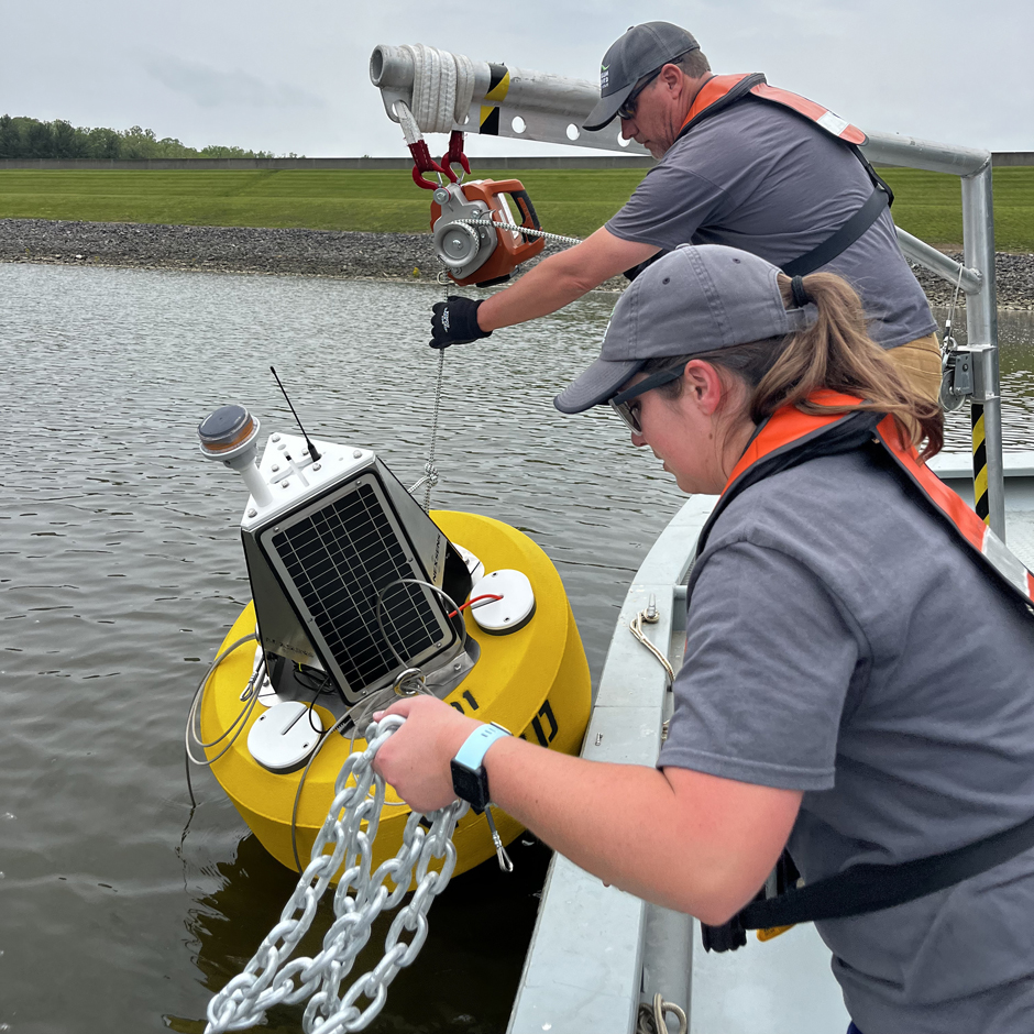
Matt Thomas and Kathryn Hamman using RV Beaver to deploy data buoy TN-01 on Tappan Lake. (Credit: Bailey Miller / MWCD)


0 comments