No Red Herrings: Data Driving the Largest Salt Marsh Restoration in the NE USA
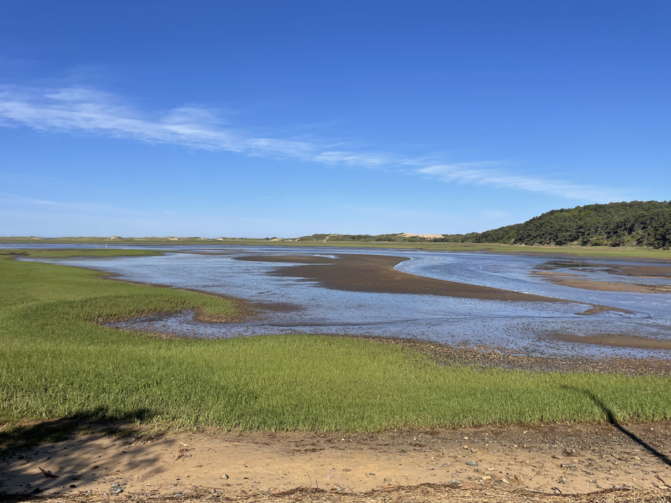
The Herring River system encompasses around 1,000 acres in the Towns of Wellfleet and Truro, Massachusetts. In 1909, the Chequessett Neck Road dike was built at the river’s mouth, drastically limiting tidal flow. Today, it’s one of the most restricted estuaries in the northeastern United States.
As a result, the area has suffered environmental decline, including poor water quality, hypoxia, lower pH, and salt marsh degradation. In 2023, the Town of Wellfleet received $14.7 million from NOAA’s Office of Habitat Conservation to fund the Herring River Restoration Project (HRRP).
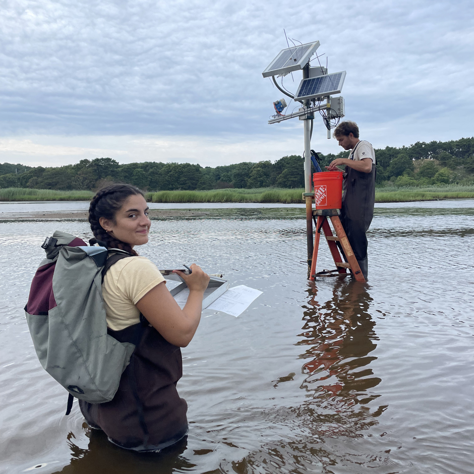
Francesco Peri, President and CEO at Charybdis Group LLC, uses a network of NexSens data loggers to monitor water level and water quality on the Herring River. Access to good data before, during, and after restoration is critical to understanding and managing an environment in flux.

Monitoring station at Bound Brook, along the Herring River. (Credit: Francesco Peri)
The Herring River Restoration Project
The HRRP aims to restore the salt marsh at the Herring River mouth by replacing the dike and culvert with a bridge. The bridge will be fitted with 12 motorized gates, controlled by trained operators.
These gates will allow the gradual reintroduction of tidal exchange–currently the Herring River has an approximate tidal range of 0.5m, compared to around three meters in the harbor–with the exact amount guided by one of several adaptive management plans, ranging from less to more conservative.
The process balances marsh recovery with the protection of nearby properties and infrastructure as this change takes place.
After a period of up to a decade–depending on the management plan selected–the gates will be removed entirely, leaving just the bridge. Culverts and road crossings in the Herring River floodplain are also being removed to help restore fish ecosystems.
Peri explains that accurate data are “essential for managing the return of tidal flow and ensuring each step stays within the modeled parameters.”
The Herring River downstream of the Chequessett Neck Road dike. (Credit: Francesco Peri)
A System in Flux
Peri emphasizes the long history of monitoring the Herring River. “We’ve collected roughly four years of baseline data ahead of bridge construction. Continuous monitoring during and after construction helps us identify and respond to any unforeseen changes.”
Indeed, with work now underway, construction has caused “noticeable sediment redistribution”–driven by a change in the location, rather than volume, of tidal flow–and “unintentional modifications to the flow.”
These changes are the latest in the history of a system in flux.
After more than a century of diking, the salt marsh has been heavily impacted. The natural tidal range of approximately three meters once brought in sediment during the flood tide, allowing the marsh to sustain and build. However, with the tidal range cut to less than 20% of pre-diking levels, the marsh has drained and collapsed.
Exposure to air decomposes marsh soils, releasing sulfuric acid into the ground and carbon dioxide into the atmosphere—an estimated 730,000 metric tons since diking happened.
With less saltwater influence, the marsh has shifted to a freshwater system, losing halophytic–or salt-loving–flora and fauna.
Named after the once-abundant river herring, the Herring River supported a thriving fishery until the early 1900s. The dike blocked passage upstream, reducing the herring population by about 90 percent. Some species, like brook trout, have vanished entirely.
Oxygen levels in the water have dropped, threatening wildlife. High pollutant and bacteria levels near the river mouth have shut down productive shellfish beds upriver of the dike.

Construction of the new bridge that will replace the tidally-restrictive Chequessett Neck Road dike is underway. Initially, the bridge will have motorized gates. Based on environmental data, tidal flow will be controlled via these gates, to ensure the sustainability of gradual ecosystem restoration. Eventually, these gates will be removed. (Credit: Francesco Peri)
Environmental Monitoring in the Herring River for Better Data
The HRRP’s environmental monitoring system uses NexSens technology, with upgrades underway to the latest X2 and X3 data loggers—user-friendly systems that “work out of the box.”
Currently, four X3 loggers are deployed. Two more will replace existing, older models in 2025, and one new station is planned.
Each logger connects to an In-Situ AquaTROLL 600 multi-parameter water quality sonde that measures temperature, conductivity, salinity, dissolved oxygen, pH, pressure, turbidity, and water level. One station measures air temperature, wind speed, and wind direction using the Vaisala WXT536 Multi-Parameter Weather Sensor.
The team also uses the YSI EXO2 sonde as a reference instrument, performing side-by-side observations while conducting routine maintenance on the AquaTROLL 600 sonde and swapping it for a clean, calibrated one.
“Water level is the essential parameter we’re measuring as we reintroduce tidal exchange,” highlights Peri. Water level is calculated via measurements of salinity–to account for water density–and hydrostatic pressure.
The sonde also measures turbidity to track suspended sediment. “We have one of the most flourishing shellfish industries on the Cape,” Peri notes. “They grow oysters on the flats just downstream of the dike and they are very worried about their oyster beds getting buried by sediment due to this transformation.”
Water chemistry is another critical focus. As tidal flow returned, dying freshwater plants released nutrients, altering soil chemistry.
“There is a lot of iron oxide in the system,” Peri says. “We pull out our sensors and they are completely rusted over, and the pH is very low. […] seawater pH is around eight, but we’ve seen pH down to 5.5”–something that has implications for wildlife.
The sondes at the Chequessett Neck Road dike get their routine maintenance. (Credit: Francesco Peri)
Real-Time Data for Vital Insights
Peri uses WQData LIVE, NexSens’ online dashboard, to access HRRP data remotely and in real-time.
Data is primarily used by the National Park Service, enabling “active management of the gates of the new bridge structure,” but it is also made publicly available.
With multiple stakeholders and landowners involved, Peri says the dashboard is accessed “all the time” and has already proven valuable.
For instance, a local golf club has to pump water off low-lying areas during spring tides–high tides that occur monthly. During one such tide amid preliminary bridge work, the water didn’t recede.
Peri explains, “The instrumentation that we had in place clearly demonstrated that the whole tidal oscillation had shifted up by about a foot. It’s an example of the importance of the data and the immediate repercussions to stakeholders on-site.”
Grants Oyster Flats at Wellfleet Town. The restoration of natural tidal exchange and the possible impact this may have on oyster farming is one of the reasons data collected by Francesco and his team is so important. (Credit: Francesco Peri)
Evolving Methods
Monitoring methods on the HRRP are continually evolving. Around three years ago, waves breached the sandbar at Duck Harbor.
“Every spring tide, there is overflow from Duck Harbor into the system,” Peri says. “That creates a little bit of confusion because you have an unexpected second tidal input.” A new monitoring station is being set up there in response.
Two buoy systems have been deployed to replace an X-Series submersible logger in the intertidal zone, which could only transmit data at low tide. “The pressure sensor is attached with the anchor of the buoy,” Peri explains. “It is at the same location as before, but now we have the data logger in the buoy, so it can telemeter at all times.”
The buoy also houses an Airmar 200WX-IPX7 Ultrasonic Weather Station with integrated GPS and Inertial Measurement Unit.
Peri is also installing microwave radar transducers at existing stations. These non-contact sensors measure water level by distance, enabling year-round monitoring—even through the harsh Massachusetts winter.
These systems operate alongside a swathe of other environmental monitoring, including terrestrial LiDAR scans and direct sediment monitoring using altimeters.
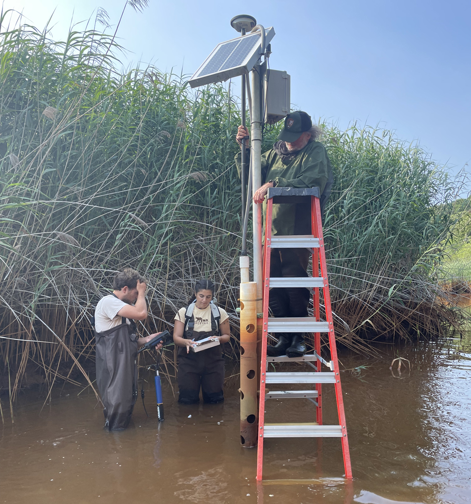
The team conducts an elevation survey at one of the real-time monitoring stations. (Credit: Francesco Peri)
A Better Environment Built on Better Data
The HRRP aims to improve water quality, restore rare species habitat, revive failing fisheries, and boost recreation. It’s also expected to aid the fight against climate change—healthy salt marshes absorb carbon dioxide and methane, and serve as natural flood defenses.
Data is key to guiding the transition to full, natural tidal exchange on the Herring River and providing a quantitative basis for key decision-making, both in the day-to-day operation of the new bridge’s tide gates and longer-term management plans.
Peri concludes, “We know the importance of monitoring data, and most importantly, we know the importance of real-time monitoring. It gives us the immediate ability to go and make further observations when needed, and see things which otherwise might not be observed or missed altogether.”


0 comments