LI-COR LI-1500 Light Sensor Logger
- Free ground shipping
- Expedited repair and warranty service
- Lifetime technical support
- More
- Weather resistant console constructed to withstand impact
- Sample and log measurements up to 500 Hz
- Optional GPS for recording location of measurements
Overview
The LI-COR LI-1500 is a light sensor logger with a menu-driven interface, making it easy to use. Attach LI‑COR light sensor(s) to the three BNC connectors. Log manually or use menus to set up one-time, daily, or continual measurement routines. Sampling rates and logging intervals are user-selectable.
Durable
The LI‑1500 features rugged housing and a compact design suitable for handheld outdoor use. A rubber seal between the two halves also serves as a shock cushion. The LI‑1500 is powered by four AA batteries providing over 80 hours of operation with typical usage or 40 hours with the GPS option turned on. Power can also be supplied from an AC wall outlet with the provided USB adapter.
Data Presentation
Graph large data sets using LI‑COR’s FV7x00 software, available for free download. Also, view real-time light measurements, GPS data, and other variables on the eight-line display screen.
Data Storage
The LI‑1500 stores a large amount of logged data on an internal SD card (1 GB of flash memory). Store up to 100 sensor configurations and sensor-specific calibration coefficient information for later use. Download the sensor’s calibration certificate from the LI‑COR website. Enter the calibration coefficient (multiplier) and the date of the last calibration just once. When attached to a computer, the LI‑1500 acts as a mass-storage device with a simple drag-and-drop file system. Logged data can be transferred to a computer with the included USB cable. Data is formatted for easy import. Configurations and sensor calibration data can also be transferred to a computer and then shared with other LI‑1500 units
Connections
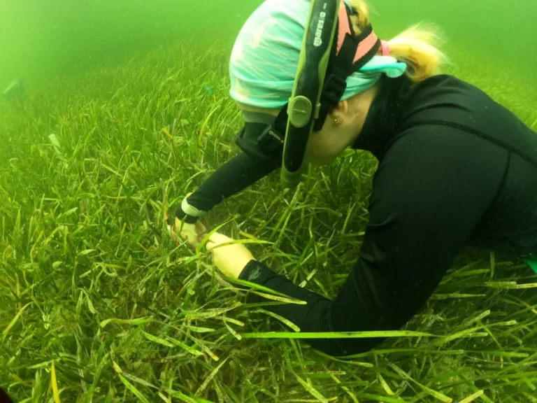
Use the LI‑1500 with LI‑COR sensors to log photosynthetically active radiation (PAR), global solar radiation, and light (the visible spectrum). PAR can also be measured along transects under a plant canopy with the LI-1500. Connect up to three sensors at the same time. For instance, use two PAR sensors to measure incident radiation above and below a plant canopy. Features a built-in math function for measuring vertical attenuation using two underwater PAR sensors. The three input ports also allow for the measurement of incident PAR above water while measuring simultaneous upwelling and downwelling PAR below water.
Global Positioning System (GPS)
The LI‑1500 features an optional global positioning system (GPS) for recording the location of measurements. The GPS facilitates repeated visits to the same location for tracking light levels over time. GPS data can be logged independently or with light data.
- (1) LI-1500 light sensor logger
- (4) AA batteries
- (1) USB cable
- (1) AC to DC power supply adapter
- (1) Carabiner clip
- (1) Carrying case
- (1) Instruction manual
- Weather resistant console constructed to withstand impact
- Sample and log measurements up to 500 Hz
- Optional GPS for recording location of measurements
Overview
The LI-COR LI-1500 is a light sensor logger with a menu-driven interface, making it easy to use. Attach LI‑COR light sensor(s) to the three BNC connectors. Log manually or use menus to set up one-time, daily, or continual measurement routines. Sampling rates and logging intervals are user-selectable.
Durable
The LI‑1500 features rugged housing and a compact design suitable for handheld outdoor use. A rubber seal between the two halves also serves as a shock cushion. The LI‑1500 is powered by four AA batteries providing over 80 hours of operation with typical usage or 40 hours with the GPS option turned on. Power can also be supplied from an AC wall outlet with the provided USB adapter.
Data Presentation
Graph large data sets using LI‑COR’s FV7x00 software, available for free download. Also, view real-time light measurements, GPS data, and other variables on the eight-line display screen.
Data Storage
The LI‑1500 stores a large amount of logged data on an internal SD card (1 GB of flash memory). Store up to 100 sensor configurations and sensor-specific calibration coefficient information for later use. Download the sensor’s calibration certificate from the LI‑COR website. Enter the calibration coefficient (multiplier) and the date of the last calibration just once. When attached to a computer, the LI‑1500 acts as a mass-storage device with a simple drag-and-drop file system. Logged data can be transferred to a computer with the included USB cable. Data is formatted for easy import. Configurations and sensor calibration data can also be transferred to a computer and then shared with other LI‑1500 units
Connections
Use the LI‑1500 with LI‑COR sensors to log photosynthetically active radiation (PAR), global solar radiation, and light (the visible spectrum). PAR can also be measured along transects under a plant canopy with the LI-1500. Connect up to three sensors at the same time. For instance, use two PAR sensors to measure incident radiation above and below a plant canopy. Features a built-in math function for measuring vertical attenuation using two underwater PAR sensors. The three input ports also allow for the measurement of incident PAR above water while measuring simultaneous upwelling and downwelling PAR below water.
Global Positioning System (GPS)
The LI‑1500 features an optional global positioning system (GPS) for recording the location of measurements. The GPS facilitates repeated visits to the same location for tracking light levels over time. GPS data can be logged independently or with light data.
- (1) LI-1500 light sensor logger
- (4) AA batteries
- (1) USB cable
- (1) AC to DC power supply adapter
- (1) Carabiner clip
- (1) Carrying case
- (1) Instruction manual
Select Options


Customer Stories